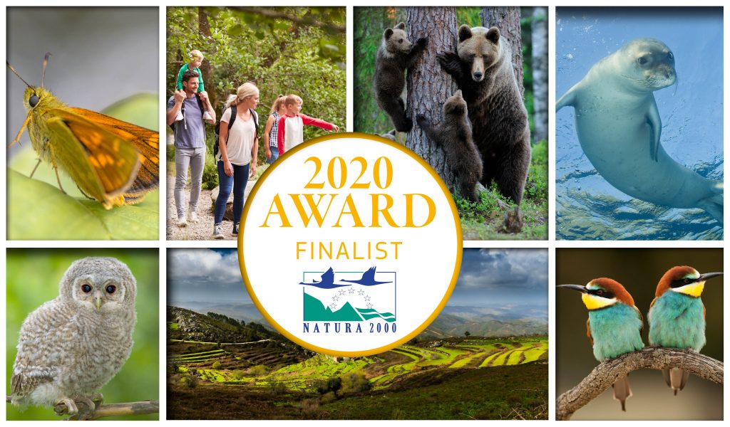
On World Peatlands Day 2020 (02 June), ‘The Living Bog’ Irish raised bog restoration project, co-funded by the NPWS of the Department of Housing, Heritage & Local Government and the EU’s LIFE programme was nominated for one of Europe’s top environmental awards.
The Living Bog, which commenced in 2016 and finishes in December 2021, was among 27 international finalists for the European Commission’s Natura 2000 Awards.
The awards recognise excellence in the management of Natura 2000 sites. The work of Living Bog Public Awareness Manager Ronan Casey with an impressive public awareness campaign and his work with local community groups attached to project sites, saw The Living Bog is nominated in the ‘Communications’ category.
Ronan’s work on communicating the importance of raised bogs and Natura 2000 sites and the work in the local community and the involvement of community groups and individuals – including former turf cutters – in project actions was recognised by the European Union’s environmental bodies as being particularly impressive.
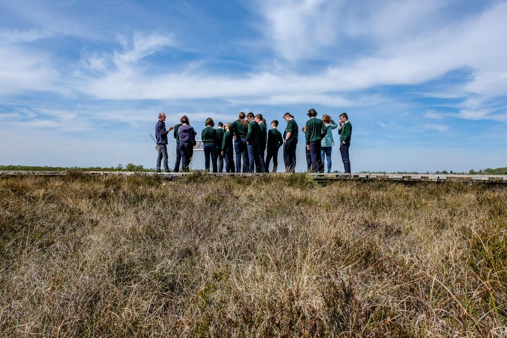
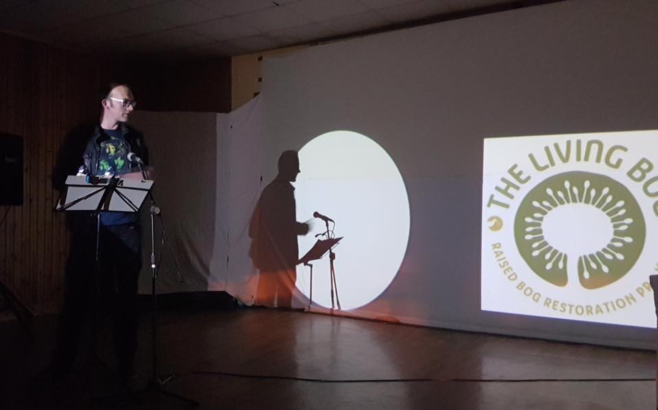
Ronan Casey of The Living Bog project leading an educational tour on Clara Bog SAC, Co Offaly. Pic: Emily Toner, National Geographic.
A high-level jury decided on five winners, but from the finalists the public will also chooses its winner: The Citizens’ Award. The Living Bog finished third in this area.
Since the Natura 2000 awards started in 2014, there have been no Irish winners in any category.
The Living Bog was delighted to have been nominated.
Congratulating the project team on the nomination, the then Minister with responsibility for Heritage, Josepha Madigan TD, commented: “I am delighted that the work of the Living Bog with local communities has been recognised with its nomination for a Natura 2000 Award. This project aims to restore raised bog across 12 raised bog Special Areas of Conservation (SACs) across seven counties. Encouraging local community involvement is a significant element of the project. I wish to congratulate Ronan and the project team on its outstanding efforts to promote awareness of peatland restoration in the local and wider community.”
The Living Bog has undertaken an immersive communication and community drive since 2016, with Public Awareness Manager Ronan Casey pictured here on Clara Bog lending a hand to a tour. Pic: Emily Toner
The project is funded by the EU LIFE 2014-2020 Nature and Biodiversity Fund, with the National Parks and Wildlife Service at the Department of Housing, Heritage and Local Government the co-ordinating beneficiary. The project is undertaken by a five-person project team located in the heart of the Irish midlands ‘peat district’ in Mullingar with many local contractors from the midlands region carrying out works throughout seven counties and also lending assistance in areas such as hydrology and ecology. The economic spin-off from the project was estimated to have been over €3m to the midlands region.
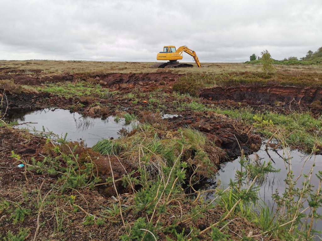
The aim of the project is to improve the conservation status of the priority habitat Active Raised Bog (EU Habitat Code 7110). This is being achieved by drain blocking with peat and plastic dams, barrier dam construction and other restoration and improvement measures. In total, almost 200km of drains have been blocked by the project with c.10,000 dams installed.
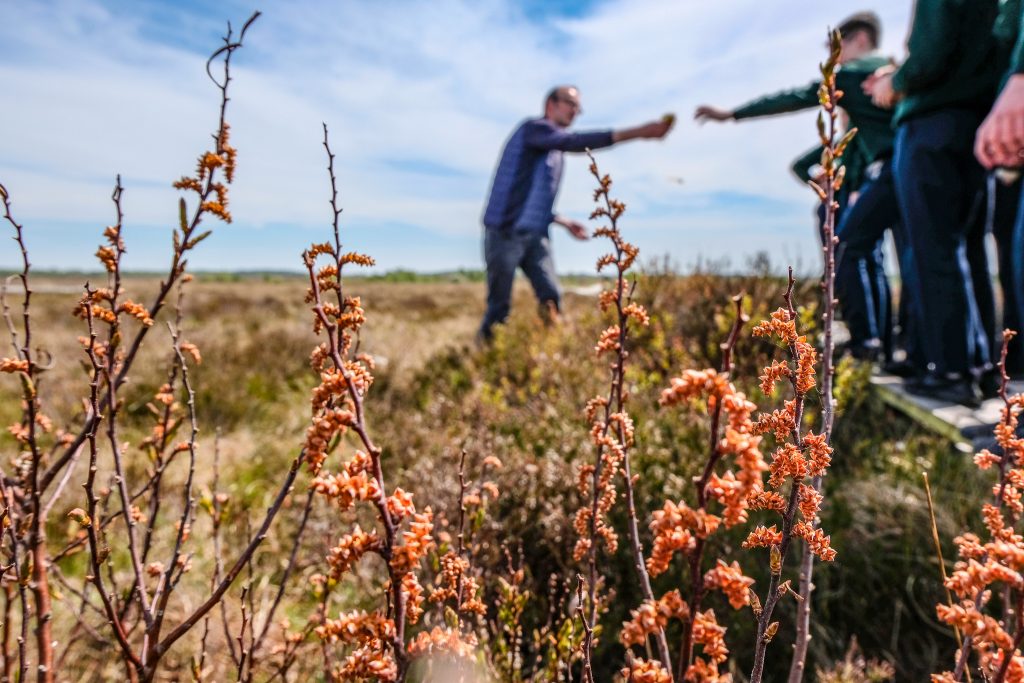
It is the project’s work in communities and communicating the importance of peatlands and the Natura 2000 Network that has been recognised by the EU. An active programme of community events, from walks and talks to children’s nature camps saw the Living Bog project establish a foothold in local communities. Community volunteers gave up many hours of their time to assist at project events and also to help on many project actions. This was further supported by an intensive social media campaign and web promotional work. A major schools outreach project was also launched. Over 100 schools were involved and children were encouraged to learn more about peatlands and bogs and espouse the benefits of restoration at home and socially.
An educational visit to Carrownagappul Bog SAC (aka Galway’s Living Bog) in Mountbellew with former turf cutters turned restoration champions Paul Connaughton and Tommy Cunningham pictured with Living Bog Public Awareness Manager Ronan Casey
Working with local community groups, the project is currently delivering or set to deliver amenity and educational facilities, including boardwalks, walking routes and educational parks, at five locations – pending planning permission decisions for a number of sites. It is anticipated that these developments will generate local health, social and economic benefits.
Notes for Editors:
The bogs involved in The Living Bog project (www.raisedbogs.ie) : Ardagullion Bog SAC, Co. Longford; Carrowbehy Bog SAC, Gorthaganny, Co. Roscommon; Derrinea Bog SAC, Co. Roscommon; Clara Bog SAC, Moyclare Bog SAC, Mongan Bog SAC, Raheenmore Bog SAC, Sharavogue Bog SAC, and Ferbane Bog SAC, all Co. Offaly; Garriskil Bog SAC, Co. Westmeath; Killyconny Bog SAC, Mullagh Co. Cavan / Co. Meath; and Carrownagappul Bog SAC, Mountbellew, Co. Galway.
The project aims to re-create the eco-hydrological conditions on these sites to consolidate over 750 ha of Active Raised Bog within an overall area of almost 2,700 ha of raised bog habitat improved. Restoration works have been completed on ten of the 12 project sites and are being monitored closely to identify site response in relation to hydrology, ecology and water chemistry. To date, results have been positive, especially in the area of cutover restoration.
On 12 raised bogs, local contractors have blocked 200 km of drains with over 10,000 peat dams. Community involvement was another big aspect of the project and it is for this they have been nominated for a Natura 2000 Award
Cutovers are where peat was extracted from the raised bogs in the past, and novel restoration techniques have seen many rare flora and fauna re-populate the sites relatively quickly after restoration works have taken place.
Active raised bogs once covered over 766,000 acres of the Irish midlands (Hammond, 1979). Turf extraction and peat harvesting on an industrial scale along with other activities have, however, stripped much of this away, to the extent that approx. 9% of the original raised bog resource remains in protected sites with less than 1% (1,639 ha) of active raised bog left nationally.
To endeavor to ensure the protection of the remaining peatlands, 53 raised bog sites were nominated for designation as SAC/Natura 2000 sites in the late 1990s/early 2000s.
The Natura 2000 Awards
The Natura 2000 Award is designed to reward excellence in the management of Natura 2000 sites (Special Areas of Conservation and Special Protection Areas) and showcase the added value of the network. It pays tribute to all those who work to make Natura 2000 a success whilst drawing public attention to its substantial achievements.
The Natura 2000 network works to ensure the long-term survival of Europe’s most valuable and threatened species and habitats, and is the centre piece of the EU’s nature and biodiversity policy. It is currently made up of over 27,800 sites. In total, it covers almost a fifth of Europe’s land area and almost 10% of the EU marine areas, making it the largest coordinated network of conservation areas anywhere in the world.
In 2014, the European Commission launched the annual European Natura 2000 Awards; the aim of which was to demonstrate what the network is, what it does to preserve Europe’s biodiversity, and how it benefits us all. The finalists chosen represent the efforts by Europeans to protect and restore nature in the EU – through conservation actions on the ground, by raising awareness about species and habitats, by highlighting the socio-economic benefits of the Natura 2000 network and by bringing stakeholders together. To date, no Irish project has won an award at the award ceremonies, held each year in Brussels.
Further Info:
The Living Bog: www.raisedbogs.ie and @LIFEraisedbogs on Facebook and Twitter.
Natura 2000 Awards: https://ec.europa.eu/environment/nature/natura2000/awards/index_en.htm
National Parks and Wildlife Service: www.npws.ie
LIFE Programme: https://ec.europa.eu/easme/en/life
Whilst on the road, in classrooms and communities, The Living Bog is often asked about the colour of water coming from, or near a bog, and if it’s safe to drink that water. The yellowish-brown colour of bog water is a familiar sight to anyone from the midlands (or indeed the uplands), and some of our rivers are sometimes coloured. What causes the colour? Dissolved Organic Matter, or DOM.
This blog explains what causes the colour and the associated impacts on water quality and hopefully answers some of the many questions out there about water from the bog, and stresses how important it is to keep that water on the bog…
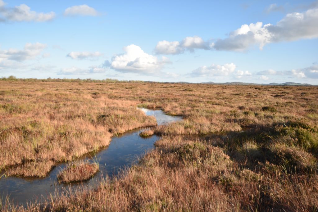
Water discharged from the bogs contains Dissolved Organic Matter (DOM). DOM is principally composed of natural acids and proteins produced by the specialist peat forming plant species unique to bog ecosystems. It is the organic forms of carbon, nitrogen and phosphates contained in DOM that are responsible for the characteristic yellow brown colour of bog water.
These natural organic compounds are stable in the bog environments, which typically have low levels of dissolved oxygen. The Dissolved Organic Carbon (DOC), Dissolved Organic Nitrogen (DON), and Dissolved Organic Phosphorous (DOP) compounds are not immediately available as plant nutrients and hence DOM is not considered as a water pollutant in its own right.
Ecologically, DOM provides a substrate for bacteria and once in a receiving water course can also acts as a natural sunscreen, reducing the depth that UV light penetrates through the water column, protecting communities of decomposers (bacteria and protozoans) that provide a streams capacity to attenuate pollutants.
Bogs in their natural state are a carbon sink. Peat forming plants like sphagnum mosses remove carbon from that atmosphere. This carbon is stored in the bog as peat where water logging inhibits natural decay processes.
Draining the bog transforms the bog from a carbon sink to a carbon source.
Carbon is lost from the peat via two pathways, as direct atmospheric exchange through soil respiration and as DOM in discharge from the drainage ditches – or channels cut into the bog to dry it out for peat extraction. A drained bog will act as a carbon source until the bog is re-wetted (or no peat remains).
The carbon flux associated with DOM can exceed direct atmospheric exchange by orders of magnitude and accounts for the majority of the carbon flux from a ditched bog. Up to 90% of the carbon lost from degraded bogs is exported via drainage discharge.
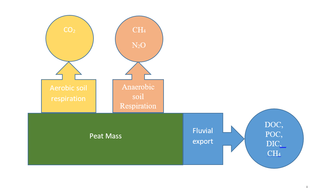
Figure 1: Pathways of Carbon losses from degraded Peatlands
Once discharged into a receiving water course with comparatively high levels of dissolved oxygen DOM the organic carbon, nitrogen and phosphorous compounds that make up DOM are broken are broken down by decomposers. These processes result in the production of carbon dioxide, and inorganic forms of nitrates and phosphates. The carbon dioxide released in this way is considered a fugitive emission in current studies of bogs in relation to climate change and is a major cause of uncertainty in estimates of the climate change potential of degraded bogs.
The nitrates and phosphates that are released as by-products from the digestion of DOM by decomposers are considered as water pollutants by the EPA. This is not due to potential impacts on human or animal health, but because they contribute to a process known as Eutrophication, which has a negative impact on the ecology of the water course. Consequently, production bogs have been identified as a significant pressure on 8% of Irish rivers at risk of not meeting their environmental quality objectives under the Water Framework Directive.
There is evidence that ammonium (a natural by-product of decay processes) is present at elevated levels downstream of production bog sites. Ammonium is a recognised water pollutant as it is toxic to some fish species at low concentrations, there is no direct risk to human health posed by ammonium in drinking water.
Nitrates in water are implicated as a cause of methemolobinemia (blue-baby syndrome), which is caused by nitrogen combining with oxygen in the blood stream in preference to iron. Epidemiological evidence suggests that this represents a health hazard in babies less than 2 months of age where micro-nutrient deficiencies exist, and hence is not likely to be a significant risk in Ireland.
The other significant water pollutants from production sites are fine peat sediments.
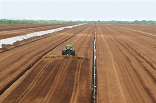
A typical peat production site in the Irish midlands
These sediments are composed of Particulate Organic Carbon (POC) suspended in the discharge from the drains. POC is not known to cause a risk to human or animal health, but can have significant impacts on stream ecology. As POC’s settle out of suspension it can blanket stream beds, negatively impacting benthic species such as the fresh water pearl mussel.
The Living Bog project is sampling water quality from selected restoration sites on a monthly basis. For example the concentration of Nitrate at the discharge point on Killyconny Bog, Co Cavan on 23/09/2019 was less than 1.67 mg/L, which is an order of magnitude lower than existing Maximum Allowable Concentration (MAC) of 50 mg/L set by the Drinking Water Directive. This concentration would be reduced significantly by dilution on entering the receiving water course.
DOC had a concentration of 45.1 mg/L and TOC 46.7 mg/L. Particulate Organic Matter (POC) present in a concentration of 1.6 mg/L. There are no published MAC’s for these parameters, so the project will seek to compare the concentrations from restored sites with the data the EPA has available on production sites over the course of the next 12 months, in order to determine how drain blocking impacts on water quality ecosystem services.
Tri-halo methanes (THM’s) are formed by a reaction between chlorine and organic compounds (principally DOM). THM’s are thought to be carcinogens as there is epidemiological evidence that prolonged exposure to THM’s leads to elevated rates of some stomach cancers. As DOM is dissolved in the bog water it cannot be removed from water via filtration or coagulation /flocculation, which are the traditional primary stages in water treatment. Hence treating water with high levels of DOM is expensive. Consequently water sources that have high levels of DOM or are highly coloured have been avoided by water supply utilities to avoid the costs of associated with treatment.
Traditionally water entering a pipeline from a water treatment plant is dosed with chlorine. This acts as a disinfectant and is an effective treatment of the main pathogens that cause serious diarrhoeal diseases such as dysentery. It is considered an essential part of the treatment process as the chlorine dose provides a residual disinfection effect as water passes through the transmission pipeline, ensuring potable quality at the consumers tap.
THM’s are not formed naturally in concentrations that would impact human health under natural conditions. They are part of a wider group of compounds collectively known as Chlorine by-products (CBP’s). There are maximum acceptable concentration limits set by the EC Drinking Water Directive for THM’s and CBP’s, and compliance monitoring is undertaken routinely by the EPA. Hence the occurrence of DOM in a peatland catchment is only likely representing a risk to human health if there is a water abstraction point downstream of the bog. This is unlikely as water utilities would not abstract surface water from a source with high DOM concentrations, it would be cheaper to pump it from a borehole. Drinking bog water without treatment will would likely cause acute diarrheal disease.
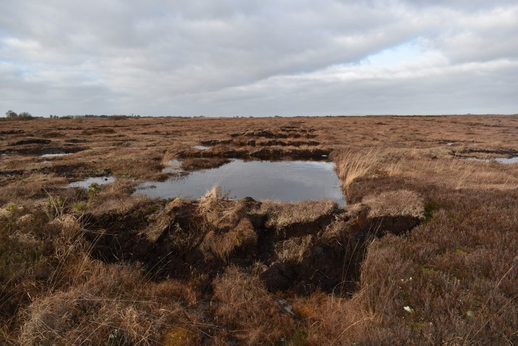
Drainage ditches on Carrownagappul Bog SAC, blocked by The Living Bog with peat dams in autumn 2019
From the above it can be concluded that restoring the bogs will have the following net benefits to the ecological status of the receiving water courses:
- Reduce the amount of sediments entering the receiving water course;
- Reduce the amount of ammonium being directly discharged into the water course.
- The impacts in relation to DOC are less clear. From first principles increasing the residence time of water on the bog surface will increase DOM concentrations, as will increased coverage of Sphagnum, as the amino acids produced by the sphagnum is a contributing factor to low pH on bogs. However there are no negative health impacts associated with the DOC and it is not considered a pollutant, and increased concentrations could well be considered an important ecosystem service function of bog restoration. The production of ammonium resulting in microbial breakdown of DOM is unlikely to cause toxicity as this process will be naturally regulated. The project will monitor the impacts of drain blocking on DOC concentrations using FDOM sensors installed in hydraulic measuring structures.
Blocking drains on the bogs will have a net positive impact on water quality. As the ecological status of the bog improves, so too will the ecological status of the receiving water course. No negative impacts on human health can be anticipates associated with water quality as water supply companies are required to control THM concentrations as part of their treatment processes.
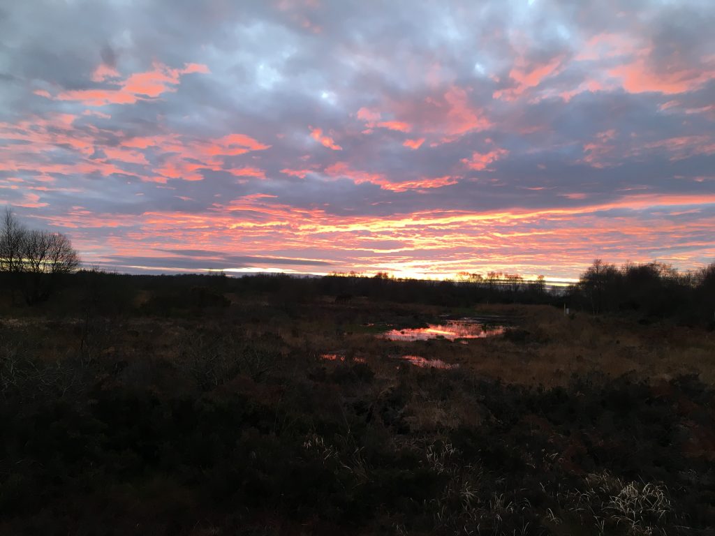
Sunset on Ardagullion Bog SAC, Co Longford, December 2019, one year after restoration works. Pic: John Cody, Hydrologist, The Living Bog.
LINKS TO NOTE:
EPA Catchment Unit, Significant pressures (peat) – https://www.catchments.ie/significant-pressures-peat/
Local Authorities Water Programme http://watersandcommunities.ie/
KerryLIFE Project: http://www.kerrylife.ie/ (Sustainable land use management for the conservation of the freshwater pearl mussel)
PAPERS
‘An overview of dissolved organic carbon in groundwater and implications for drinking water safety’ by Dr Shane Regan, Paul Hynds & Ray Flynn.
https://www.researchgate.net/publication/316351764_An_overview_of_dissolved_organic_carbon_in_groundwater_and_implications_for_drinking_water_safety
Tá portaigh ardaithe áirithe i measc na n-éiceachóras beo, garnádúrtha is sine ar domhan. Tá cuid mhór de phortaigh ardaithe móra na hÉireann ag dul siar beagnach 10,000 bliain.
I lár tíre is mó atá siad agus meastar go raibh achar de mhilliún acra talún clúdaithe acu tráth den saol. Ach é sin ráite, níl fágtha anois ach níos lú ná 1% den fhigiúr sin mar phortach beo gníomhach – Portach atá fós in ann beatha a chothú.
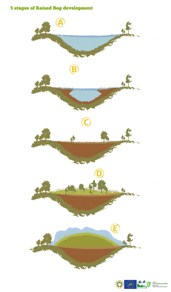
Thosaigh portaigh ardaithe ag forbairt 10,000 bliain ó shin i logáin ina raibh lochanna éadoimhne, a bhí fágtha go hiondúil ag na hoighearshruthanna a bhí ag cúlú tar éis na hOighearaoise (A.)
Ag an am, bhí an talamh á níochán ag screamhuisce ilchothaitheach agus tharla coinníollacha anaeróbacha. Ar dtús, forbraíonn sraitheanna giolcach ach éagann siad sin, tosaíonn a n-iarsmaí ag bailiú (B.) agus tagann Eanach chun cinn de réir mar a thosaíonn móin eanaigh ag bailiú.
Tosaíonn luachair, cíb, féara, luibheanna agus bláthanna fiáine, crainn agus toir ag fás agus meath de réir mar a bhailíonn an mhóin eanaigh – dorcha agus snáithíneach. (C.)
Faigheann an tsraith móna eanaigh níos tibhe go dtí nach mbíonn fréamhacha na bplandaí atá ag fás ar an dromchla in ann teagmháil a dhéanamh a thuilleadh leis an screamhuisce atá lán de chailciam. Uisce na báistí an t-aon fhoinse mianraí a bhíonn ag na plandaí anois, rud atá ar bheagán mianraí (D.)
Tosaíonn speicis portaigh ardaithe ar nós caonaigh Sfagnaim ag teacht chun cinn agus ar deireadh thiar déantar portach ardaithe den eanach. Tá na caonaigh Sfagnaim in ann maireachtáil ar uisce báistí gan mórán mianraí agus bíonn an mhóin bhog a fhorbraíonn ar an eanach os cionn thionchar an screamhuisce. Fásann plandaí atá in ann maireachtáil i gcoinníollacha aigéadacha i bhfad níos boichte in ionad na bplandaí eanaigh go léir, agus de réir mar a bhailíonn na caonaigh agus a chailltear na plandaí tagann portach ardaithe ar an saol (E.). Bíonn cruinneachán leacaithe an phortaigh ardaithe beagán níos airde ná an taobh tíre mórthimpeall air agus as sin a thagann a ainm.
Tháinig formhór na bportach ardaithe chun cinn i gcontaetha lár tíre – Uíbh Fhailí, an Iarmhí, an Longfort, Laois, Ros Comáin, Tiobrad Árann agus Cill Dara – agus i gcontae na Gaillimhe agus Oirthear Mhaigh Eo san iarthar. Fuarthas freisin iad i nGleann na Banna i dTuaisceart Éireann.
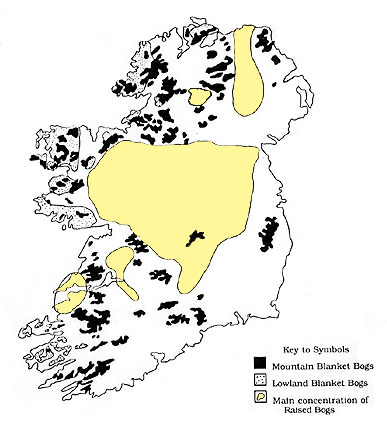
In 1979, mheas Hammond go raibh 310,000 heicteár (750,000 acra) clúdaithe ag Portaigh Ardaithe i dtús agus i lár na 1800í. Sa lá atá inniu ann, ní féidir ach 8% den fhigiúr sin a mheas mar áit atá oiriúnach le hathchóiriú agus tá 37% de caillte ó thús na 1990í. Faoi láthair, níl againn ach níos lú ná 1% is féidir a mheas mar phortach gníomhach beo agus tá an chuid is mó de sin á choinneáil taobh istigh de 53 láithreán SAC/Natura 200.
Oibreacha Uisce
Bíonn an draenáil i bhfad níos fearr ar na himill ghéara a bhíonn tirim den chuid is mó agus clúdaithe le fraoch coiteann. Tá an chuid is mó de na himill phortaigh in Éirinn gearrtha amach, go háirithe le meaisíní ó na 1970í, agus mar gheall ar an ngearradh triomaíonn agus crapann an mhóin, rud a fhágann scáintí contúirteacha doimhne.
I dtús ama, bhí stráice cúng eanaigh timpeall ar an gciumhais, áit a bhí faoi thionchar an screamhuisce, ach tá an chuid is mó den ghné sin scriosta anois mar gheall ar dhraenáil agus gearradh. Is fíorannamh a fhaightear anois é.
Isteach ó na ciumhaiseanna, éiríonn an portach níos fliche agus bíonn na caonaigh Sfagnaim i mbarr réime – tá breis agus 20 cineál díobh ann ach is iondúil gur ceithre nó cúig chinn a bhíonn an-choitianta. Déanann cuid acu tulóga (atá in ann a bheith méadar ar airde agus iad clúdaithe ar an mbarr le fraoch agus caonaigh dhifriúla) agus faightear cinn eile i loig agus i locháin. Tá éagsúlacht iontach ina ndathanna – glas, oráiste, dearg agus donn – agus tagann dathanna eile ar chuid acu san Fhómhar agus sa Gheimhreadh, dathanna éagsúla dearga go príomha. As na plandaí a bhíonn ag meath agus na ceannbháin, a fuair siad an t-ainm ‘portaigh rua’. Sna háiteanna níos fliche, fásann gobsheisc, sciollam na móna, ceannbháin agus plandaí neamhchoitianta eile, agus fásann pónairí corraigh agus lusanna an bhorraigh sna locháin. Faightear andraiméid agus mónóg, lena gcaora dearga agus a mblas géar, ag sníomh trí bhratacha Sfagnaim agus bíonn drúchtíní le fáil go fairsing freisin. Forbraíonn léicin – Sceir Coiréil na hÉireann – i bpaistí. In ainneoin nach áiteanna an-fháilteacha iad na portaigh ardaithe, bíonn an rath ar na céadta de phlandaí agus d’ainmhithe sonracha portaigh iontu.
The Living Bog is actively working in the local communities surrounding our sites to collate as much information as possible about our bogs, and to record the local stories about the local bog that otherwise may well be lost in the passage of time. What is ordinary to those who may have lived there, or who heard stories or local folklore may well be extraordinary to those from elsewhere.
With that in mind, we asked Seamus Crawley of the Gortaganny Development Association to raid his own personal archives, and with the help of Seamus Kenny the following contains some extraordinary local history: Evidence of an important Togher Road (then and now) and of spuds in the bog! Enjoy!
The general area of west Roscommon and east Mayo extensive area is primarily that of a mix of arable land and bogland with a number of interspersed lakes. All records allude to lake connectivity via streams, rivers and indeed underground water passages/streams often referred to as ‘sinking rivers’. The landscape and associated quality is noted as been influenced by the extensive limestone content and turloughs in the area.
As regards the bogland specifically in the area, a feature of the general landscape is the mixture of arable lands in more elevated areas with drumlin-like, or esker-like, features. As regards the bogland itself, it is likely that the extensive bog areas were manipulated by ancestral populations over many years.
While noting that detailed archaeology studies could confirm much greater information, there are a couple of initial research examples that are worthy of further investigation.
-
TOGHER ROAD
In the late 18th and early 19th century in a pre-famine Ireland, extensive land and mapping surveys were conducted around West Roscommon. Some of the surveys were conducted by legislators, ordinance officers or, in many cases, by local landlords.
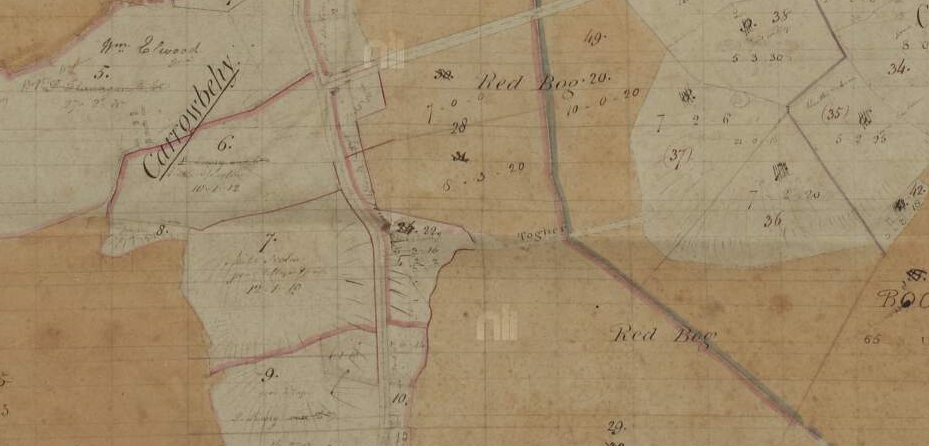
Below is a copy of a more extensive map survey area of Carrowbehy district (from National Library archives) which record a ‘Togher Road’ clearly defined between the land mass area of Cahir and Carrowbehy, between the old ‘Red Bog’ names of the bog.
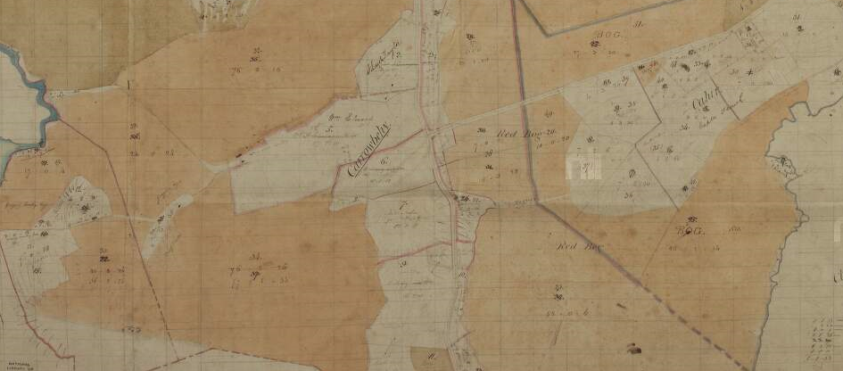
The survey was conducted in March 1830 and compiled in subsequent weeks. This road is typical of a likely location of a ‘togher’ which were extensively used and improved by local farmers in the Bronze Age and into the pre-Christian Iron Age.
The purpose of these trackway types made of wood was simply as a suitable method of passing undrained marshy land masses. The most intriguing detail relevant to the recording of this togher road is that it was recorded in the respective survey and may suggest that it maybe still in use or at the very least it still left a mark on the local landscape. Indeed, it may be probable that the ancient trackway was modernised by the use of stone and elevated to some extent accordingly. You can see it marked more clearly below.
Regardless, the fact it was recorded and where it was located opens up a great opportunity for research purposes relative to this ‘togher’ location and indeed the likelihood of more of this trackway type around Carrowbehy bog. The actual topography of this road and map area could easily suggest the most likely locations of other ‘Togher’ road types in Carrowbehy bog.
WHERE IS IT TODAY?
From the outset, the most relevant concern that needs to be examined is ‘where is this road today?’ Firstly, the march of subsequent progress in the district may offer a likely possibility. Noting that this map was a pre-famine survey, the more modern link road from Ballyhaunis to Loughglynn was improved in circa 1860s. This new road would have crossed this Togher road. The concern may be that any material on this Togher road may have found its way on to the new improved road. It is worth checking in any case!
(Also note that this map of 1830 does not record the ‘New Line’ road in Erritt. This may suggest that this road was most likely constructed in the 1830’s)
The Living Bog had a go at layering maps, with thanks to the OSI for allowing us to use their online maps. We overlayed the 1830’s map onto a current aerial view.
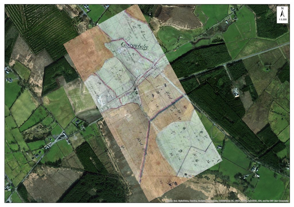
An overlay of the historic map onto a more recent OSI map.
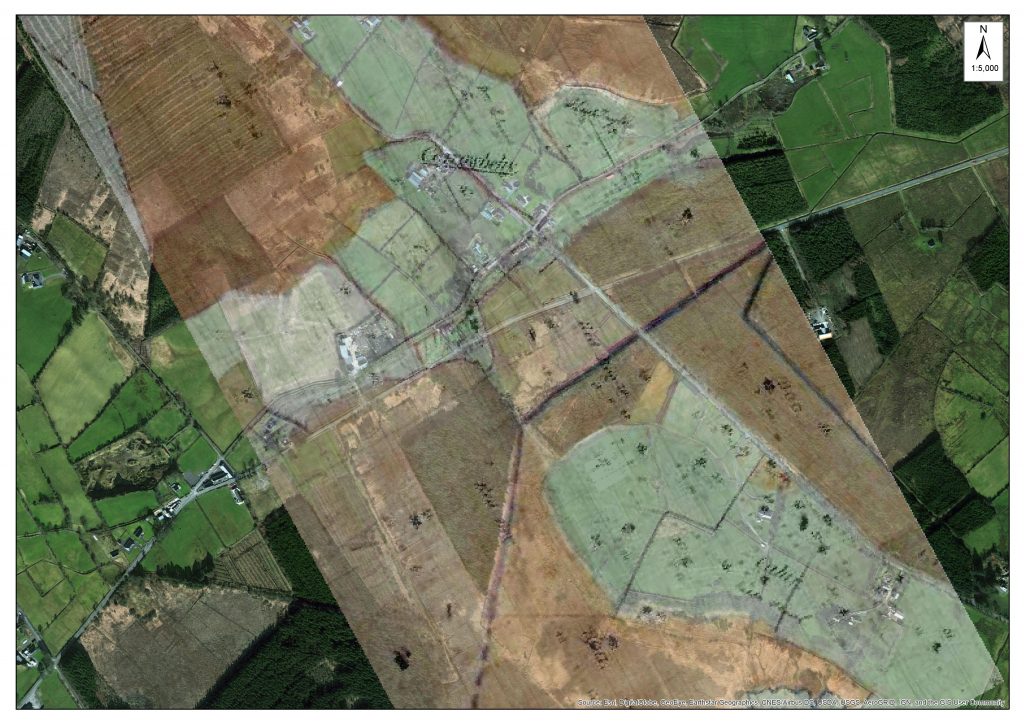
Using OSI maps, here is another look at the two eras with the Togher Road in the centre of the photo.
From overlaying the old maps onto more recent aerial imagery, it’s clear the ‘path’ of the old Togher Road is still there, alongside some forestry. It has been covered over substantially in recent years, and if not dissolved or disappeared it may well be subsumed by the march of earth and growing bog.
What is interesting to see if how the landscape changed in this small area over the course of almost 200 years. Where turf was not cut by traditional means, the old ‘Red Bog’ was forested and later reclaimed and put into use as agricultural land. Much of Ireland’s bogland was afforested over the last 150 years, quite a bit with non-native trees. Other LIFE projects in Ireland have concentrated on removing some of this forestry with some degree of success.
If you look at a recent clean aerial shot (from Bing Maps), you can still see the line of the Togher Road (between the red arrows), despite the changes to the surrounding landscape.
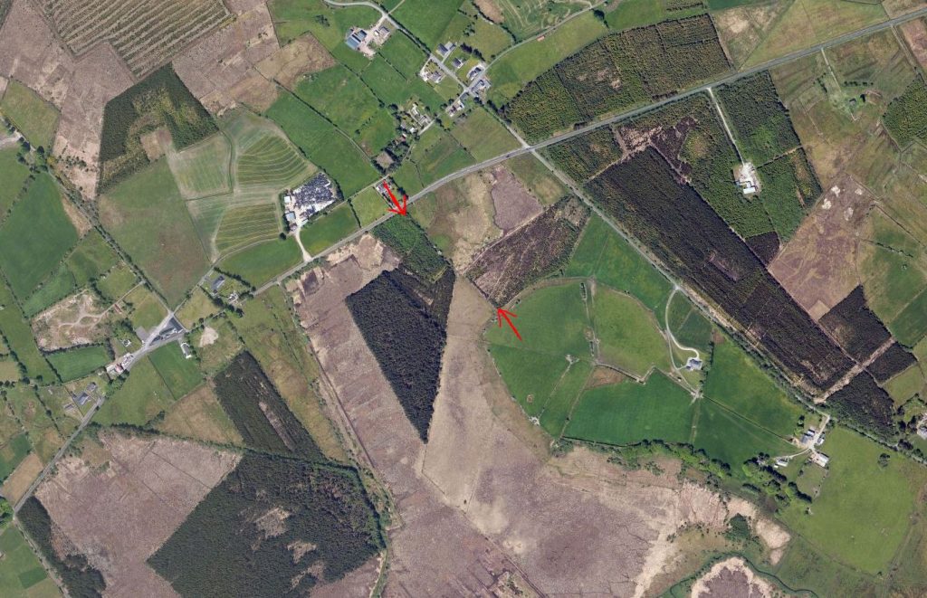
Aerial view from Bing Maps 2017: The area where the Togher Road was in indicated between the two arrows.
-
CULTIVATION OF BOGLAND aka ‘SPUDS ON THE BOG’
A more modern synopsis of farming practises in the 19th century notes the increased populations in West Roscommon and the country in general and the attempts to utilise bogland areas for more liveable and active agricultural purposes. This can be attributed to some marshy or cutaway lands that have been used for semi-arable farming and grazing purposes.
After the famine and the continual human burden of survival, the local steward of the Erritt Lodge estate conducted a research project in attempting to facilitate bogland area to grow potatoes of an acceptable standard.
Details attached from 1870 newspaper.
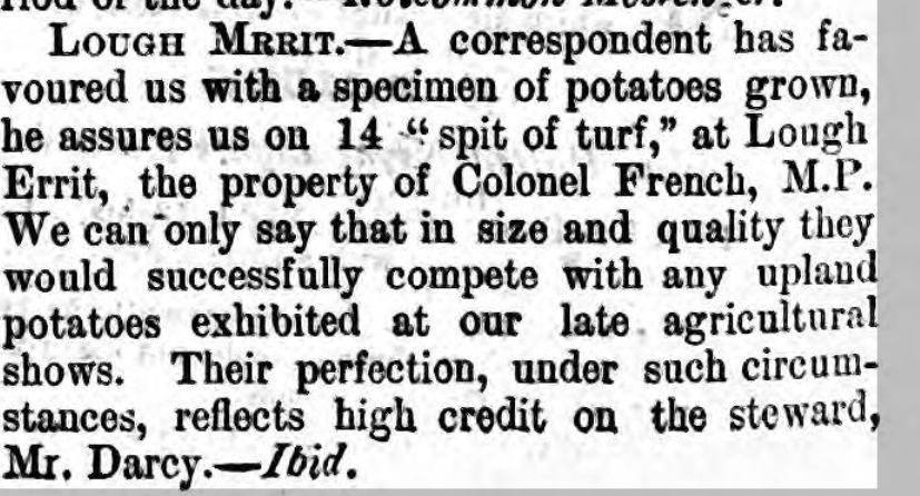
It is likely that this was a feature of both pre-famine and post famine activities in growing potatoes in bogland area. However, the attached detail seems to declare a more national newsworthy success in enabling the growth of potatoes!
This story adds to the extensive details recorded in both the Dillon and De Freyne estates in attempts in utilising bogland for more agriculturally productive requirements. Again, this detail is not of relevance to an ancient or medieval use of boglands, but it does illustrate ways that local communities tried to utilize and improve the use of boglands around Carrowbehy and district for more agricultural productive purposes in times past. (Other examples attained relevant to medical, conservation and lifestyle purposes).
UPDATE! November 9, 2017
Just as we posted this blog post on Nov 7th, a contract ecologist working for the Living Bog, George Smith of Blackthorn Ecology, just happened to be on Carrowbehy Bog undertaking some additional survey work. He had just come across a section of cut-over bog when he came upon a series of ridges, or lazy beds.
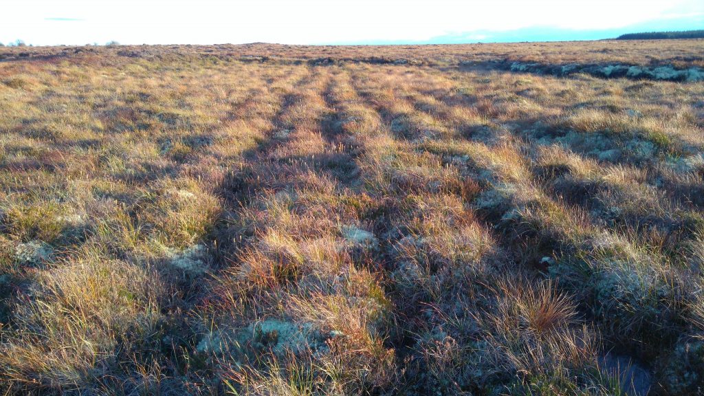
Lazy beds at Carrowbehy Bog SAC, photographed during survey work by George Smith, Blackthorn Ecology.
George says the series of ridges certainly seemed to be hand-dug, and were not the result of a machine on the bog. Peat extraction by machine did happen at Carrowbehy Bog SAC in the past, but it has been some time since machines were on the bog, and the presence of lichens and hummocks suggest these ridges have been there for some time.
George posted his pic to Twitter saying: “Lazy beds on cutover bog at the edge of Carrowbehy Bog. How desperate people must have been!”
Lazy beds on cutover bog at the edge of Carrowbehy Bog. How desperate people must have been! pic.twitter.com/upgetLxjPk
— Blackthorn Ecology (@BlackthornEcol) November 7, 2017
Are these the evidence of the ‘spuds on the bog’ experiment? Or did locals learn from it and attempt to grow their own spuds on the bog?
We’ll post an update soon….
-
MUSIC AND MYSTERY
When Seamus Kenny was collating the history and some stories for the Erritt Lodge book a couple of years ago, more stories emanated or in some cases some ‘heresay’ and rumours became more real after book completion!
As an example, more information on the French/Blake families in the district and the utilisation of Erritt Lodge for Feiseanna (Feis) in the early 20th century. Not alone was Jim Coffey and ‘Count’ John McCormack reputed to have visited the the Lodge, others such as acclaimed songwriter and performer Cathal McGarvey (Gaelic revivalist and writer of the ‘Star of the County Down’) is recorded to have performed at Erritt Lodge. Even more interesting is that a record exists of a photographer visiting a successful Feis at Erritt Lodge in the summer of 1907 and taking pictures with his Kodak camera!
Seamus also found details about the ‘White lady of the lake’… Keep checking into the website here for an update…
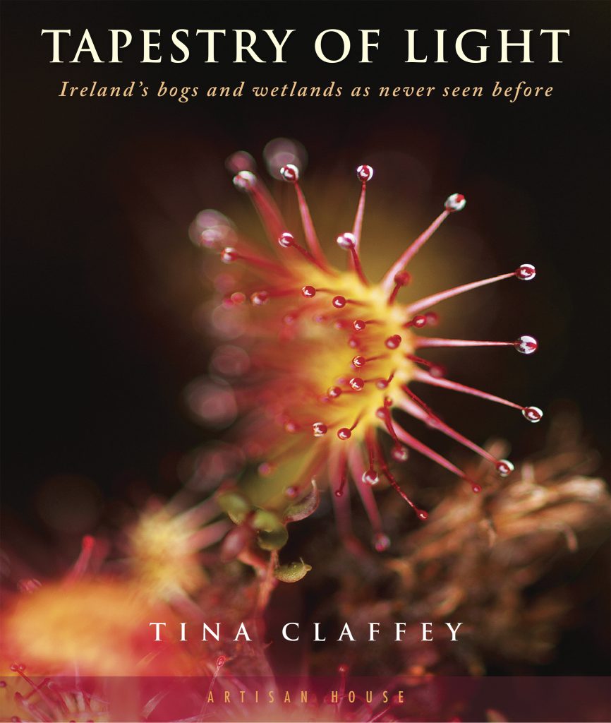
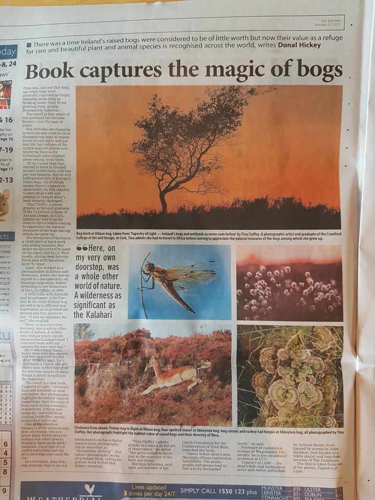
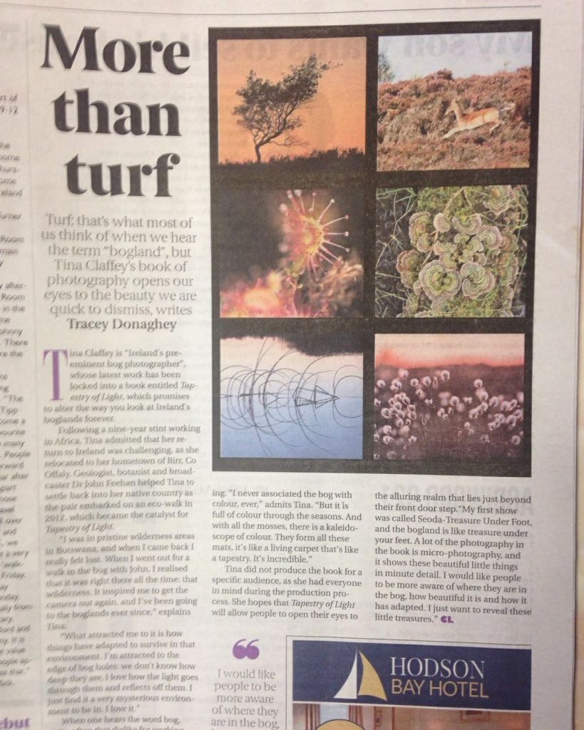
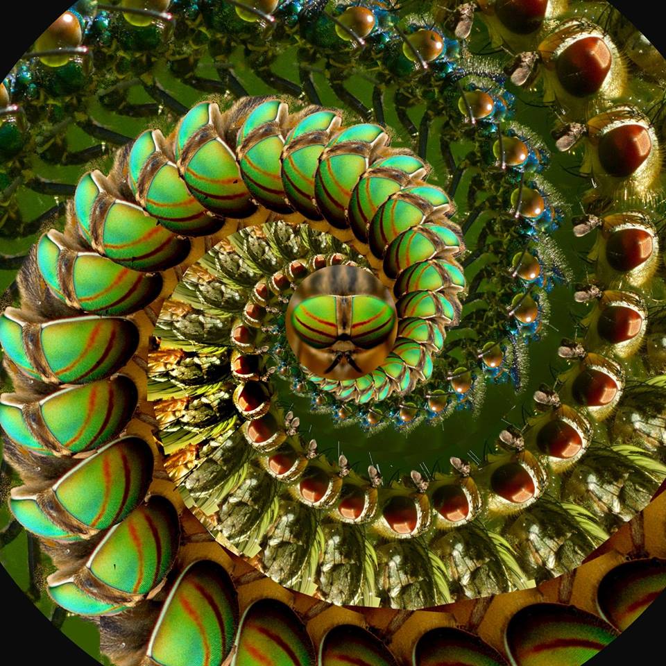
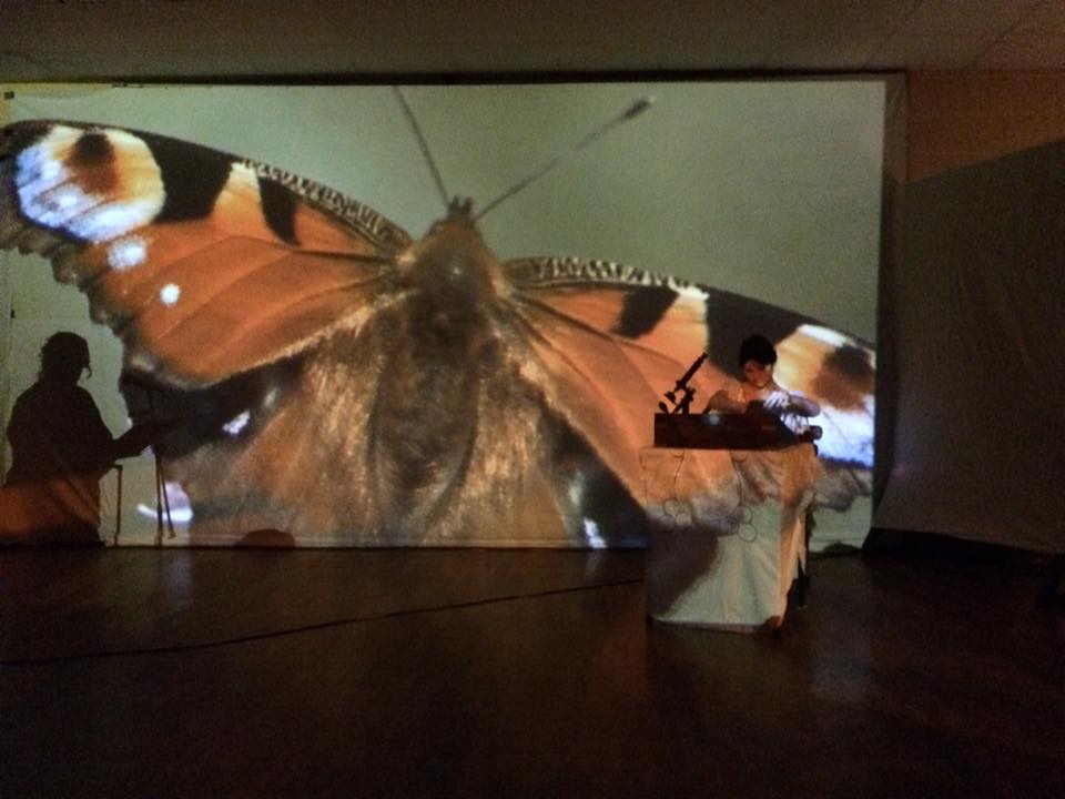
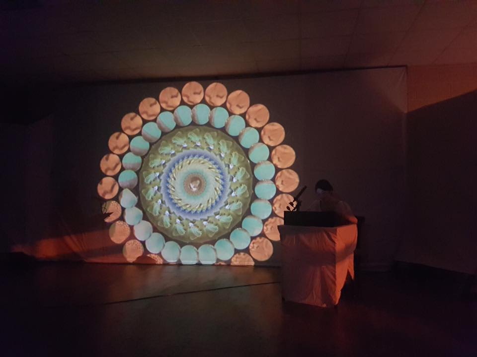
The Living Bog has been both delighted and honoured to have played a small role in the creation of one of the finest books about bogs ever produced. ‘Tapestry of Light’ by renowned Birr, Co Offaly nature photographer Tina Claffey was released to widespread critical and commercial acclaim in October 2017, on Artisan House books. It is a stunning book, the ideal gift for anyone with more than a passing interest in the wonderful world of Irish nature and our native peatlands, which are among the world’s oldest near-natural eco-systems.
We met Tina early on in the Living Bog project. She is a vastly experienced nature photographer with an innate love for Ireland’s bogs, peatlands and wetlands. She grew up in Offaly, surrounded by bogs, but her journey to capture the bogs of Ireland in her unique style was helped greatly by a bog walk by legendary Offaly ecologist, geologist, botanist, author and broadcaster Dr John Feehan. For almost 10 years prior to this, Tina lived and worked in pristine wilderness areas in Botswana, and this experience awakened an appreciation of the natural world of her home country. Since her meeting with John, she started to publish her photography online and it was there where we encountered her first.
Since we got to know her, Tina has photographed many of Ireland’s most important raised bogs, including some of the Living Bog’s 12 project sites. Her beautiful images reveal the commonplace as something new and exotic.
Her unique perspective of the flora and fauna of the unspoilt raised bogs and wet woodlands of the Irish midlands are celebrated on every page of Tapestry of Light – Ireland’s bogs and wetlands as never seen before.
This 156 page, highly-illustrated and beautifully designed hard-back book shows bogs in a new light, and it would be a great gift for anyone who appreciates not just bogs but Irish nature and the environment. The book will ensure that the reader will never view Irish boglands in quite the same way again.
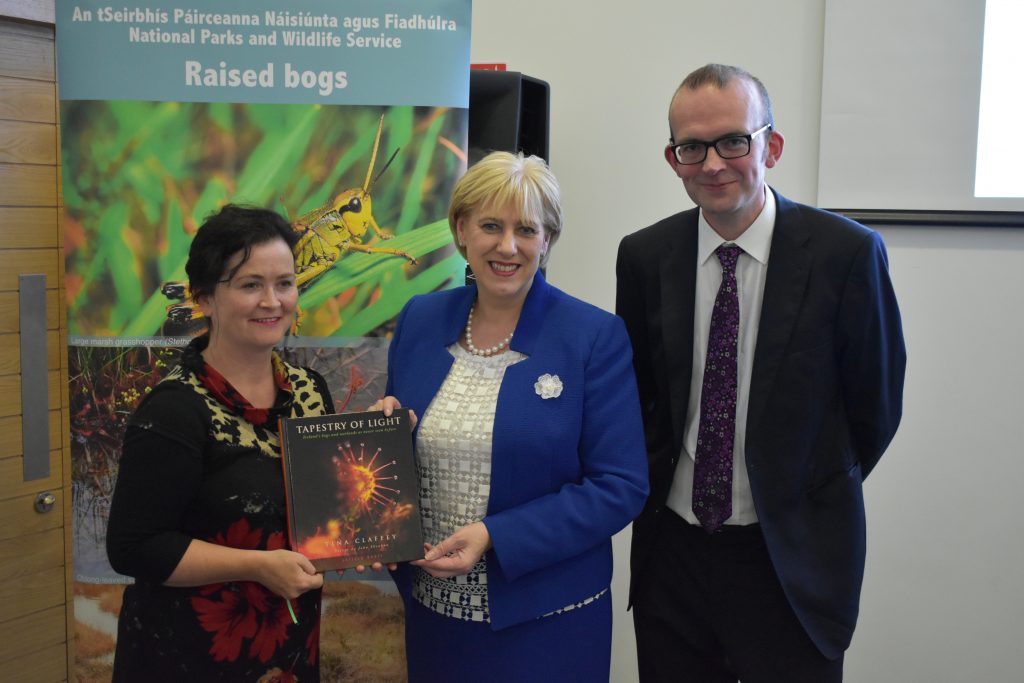
Birr nature photographer Tina Claffey presented the first copy of her new book ‘Tapestry of Light’, which was part-funded by ‘The Living Bog’ and the Department of Culture, Heritage and the Gaeltacht to Minister of Culture, Heritage and the Gaeltacht Heather Humphreys at the ‘Living Bog’ launch. She is pictured with Ronan Casey of ‘The Living Bog’. Pic: James Flynn APX
The Living Bog have been delighted to have worked with Tina, and she was at the official launch of The Living Bog in Clara on Friday, September 15 whereupon she presented the Minister for Heritage, Culture and the Gaeltacht, Heather Humphreys TD with one of the first copies of the book. The now former Minister of the Department was most impressed with the book and wished Tina every success in the future.
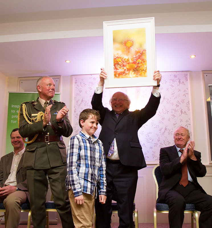
A week later and Tina struck again, presenting no less a person than the President of Ireland, Michael D Higgins, with two special copies of the book at the National Ploughing Championships, held in Screggan, Tullamore, Co Offaly. The President was delighted to meet Tina and her son Tristan again. The last time they met, at the launch of the Community Wetlands Forum in Abbeyleix, they presented him with a beautiful framed photograph of a round-leaved sundew, which he told Tina at the Ploughing, now hangs proudly in the Áras.
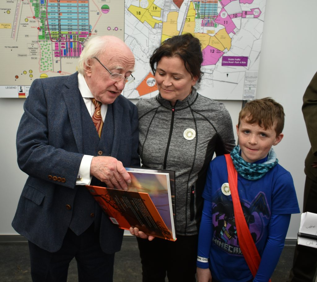
Tina Claffey and her son Tristan presenting the President of Ireland, Michael D Higgins, with a copy of ‘Tapestry of Light’ at the National Ploughing Championships on Tuesday, September 19. Pic: Ronan Casey
Tapestry of Light was officially launched in Dublin on October 12 2017 by Dr Matthijs Schouten. In case you were wondering about the title ‘Tapesty of Light’, well, it is taken from the eponymous poem by John Sheahan, the renowned musician and composer with the famous folk group, The Dubliners, and that great man was also at the launch.
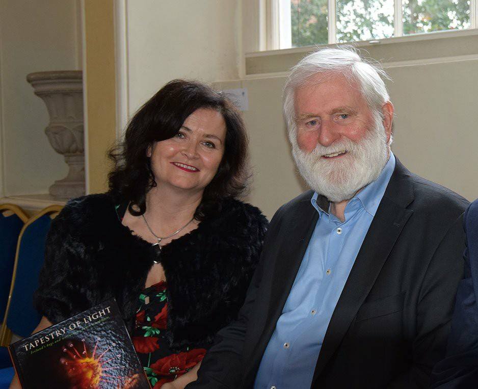
Tina Claffey and John Sheehan at the launch of ‘Tapestry of Light’ in Tailors Hall, Dublin, October 2017
The book includes a foreword by Dr. John Feehan and is published by bespoke publishers Artisan House in Connemara.
The Dublin launch was a well-attended event, and it saw ‘Tapestry of Light; pick up some very positive newspaper coverage, with The Irish Times, the Farmers Journal, and Irish Examiner in particular writing about the book. Later in the year, both the Times and Examiner would recommend the book in their ‘end of year’ lists.
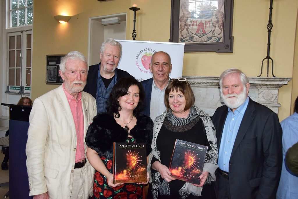
Pictured at the ‘Tapestry of Light’ launch in October 2017 are John Feehan, who wrote the foreword, Vincent Murphy of Artisan House, Tina, Claffey, Matthijs Schouten of the Dutch Federation of Conservation of Irish Bogs who launched the book, Mary Ruddy of Artisan House, and John Sheahan whose poetry is infused throughout the book.
You can order the book online HERE and it is also available in all good book stores.
To keep up to date with Tina and to see her excellent photography daily, she has a TWITTER page HERE and a FACEBOOK page HERE
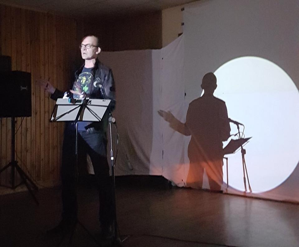
MOONEY GOES WILD
RTÉ Radio 1, broadcast date: Sunday, 12 November 2017
The Living Bog was the subject of a special report on RTÉ Radio 1’s ‘Mooney Goes Wild’ programme – Ireland’s biggest nature show. Derek Mooney’s roving reporter, the legendary Eanna Ní Lamhna came to Clara Bog for the broadcast, and interviewed Ronan Casey of ‘The Living Bog’, Dr John Feehan and Tina Claffey.
You can listen back to the broadcast HERE
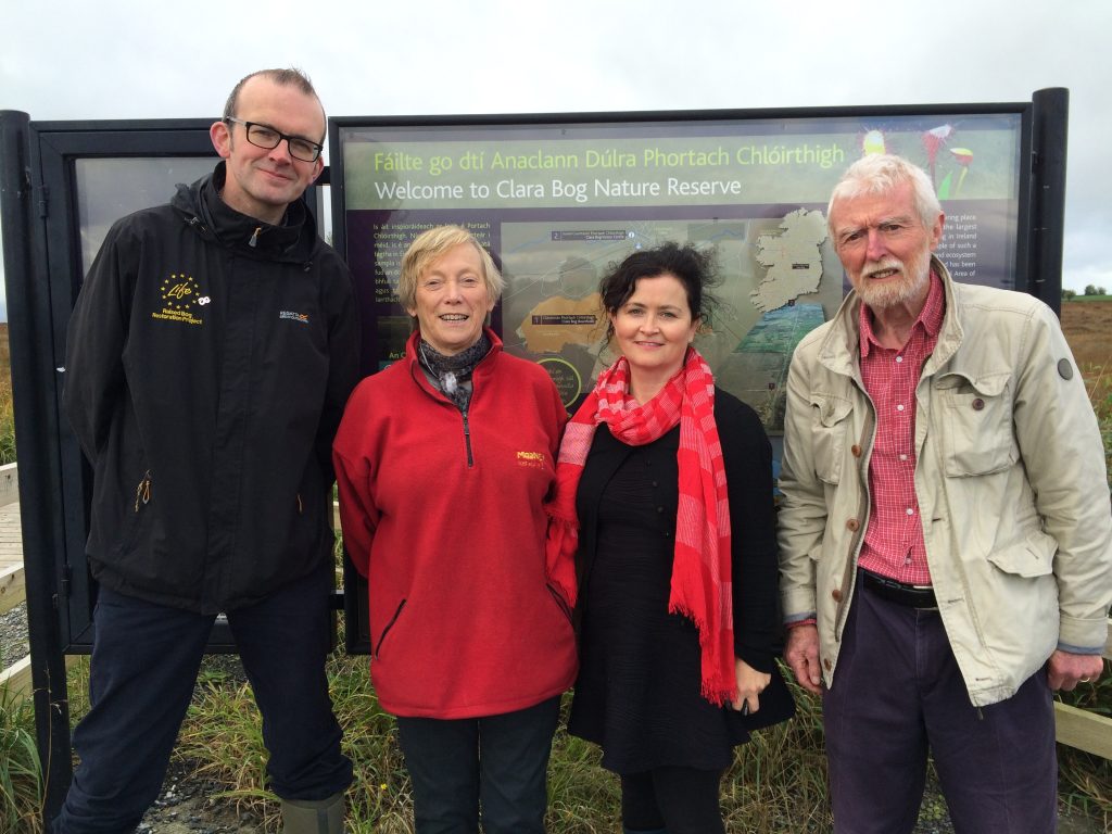
Ronan Casey of the Living Bog, Eanna Ni Lamhna of RTÉ, Tina Claffey and Dr John Feehan at Clara Bog SAC in November 2017.
Sample press coverage for ‘Tapestry of Light’:
The Irish Times
Online feature HERE
https://www.irishtimes.com/news/environment/tapestry-of-light-fabric-of-our-bogs-explored-in-pictures-1.3271298
Best Nature Books of the Year, by Michael Viney, HERE
Irish Examiner
Feature on the book HERE
Farmers Journal
Feature on the book HERE (log-in may be required)
Clara Bog Visitor Centre Exhibition
In the run up to the launch, for most of September and October, some photographs from Tina’s ‘Elements’ exhibition were on display at the Clara Bog Nature Reserve Visitor Centre in Clara, Co Offaly. The exhibition has since moved. Check out Tina’s FACEBOOK page for more info on it, the book and for daily updates featuring wonderful bog photography.
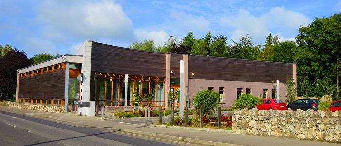
Clara Bog Visitor Centre
The President and the Sundew
Flashback! To the launch of the Community Wetlands Forum in May 2017 when President Higgins was presented with his ‘Sundew Goddess’ print by Tina Claffey’s son Tristan. The Living Bog have been honoured to use this image in our promotional brochures, posters etc. The print given to the President at the Abbeyleix Manor Hotel on May 25 now hangs in the Áras in Phoenix Park.
The €5.4 million ‘The Living Bog’ project was officially launched on Friday, September 15, 2017 at Europe’s largest raised bog – Clara Bog in Offaly – by the Minister for Culture, Heritage and the Gaeltacht, Heather Humphreys T.D.
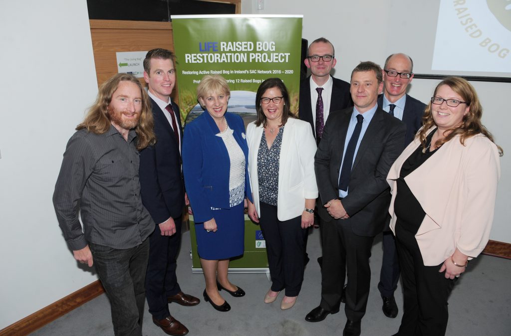
Minister for Culture, Heritage and the Gaeltacht Heather Humphreys TD pictured (third from left) with Living Bog team members (from left) William Crowley, Jack McGauley, Evelyn Slevin, Ronan Casey and John Cody. Also in the picture are Brian Lucas and Suzanne Nally from the Peatlands Unit with the Dept of Culture, Heritage and the Gaeltacht. Pic: James Flynn APX.
A large attendance was present at the award-winning Clara Bog Visitor Centre, close to the bog, for the official launch. Many community groups and individuals who have a connection to each of the 12 project sites were present at the launch, as were many political, governmental, environmental, NGO, and media individuals, as well as EU LIFE officials and a host of peatland dignitaries, activists and local landowners and farmers. The project is funded by the European Union’s LIFE Programme for Nature and Biodiversity projects and the Irish government’s Department of Culture, Heritage and the Gaeltacht.
Minister Humphreys said from an international perspective, the raised bogs of Ireland are among the most important near-natural eco-systems, and she thanked the LIFE Programme for its support in ensuring they will be enjoyed by generations to come. She said the 12 project sites could form a key part of a ‘Peat District’ in Ireland, which would attract visitors from all over the world. She equated the total area of raised bog habitat that Living Bog restoration work will improve to be akin to 7,000 major sports stadia.
The project sites (and nearest towns) are:
- Ardagullion Bog SAC, Edgeworthstown/Granard, Co Longford
- Garriskil Bog SAC, Mullingar, Co Westmeath
- Raheenmore Bog SAC, Daingean, Co Offaly
- Mongan Bog SAC, Clonmacnoise, Co Offaly
- Clara Bog SAC, Clara, Co Offaly
- Ferbane Bog SAC, Ferbane Co Offaly
- Moyclare Bog SAC, Ferbane, Co Offaly
- Sharavogue Bog SAC, Birr, Co Offaly
- Derrinea Bog SAC, Co Roscommon
- Carrowbehy Bog SAC, Co Roscommon
- Carrownagappul Bog SAC, Mountbellew, Co Galway
- Killyconny Bog, Mullagh, Co Cavan/Meath.
1% OF THE BOGS LEFT
The Minister hopes the 12 bog project will be the start of a major re-appreciation of Ireland’s last remaining raised bogs. Just 1% of the 850,000 acres of active, living raised bog mapped in the early 1810’s by Richard Lovell Edgeworth and others remains, and this alone accounts for almost 50% of the active, living raised bog in Western Europe.
“This is biggest single raised bog restoration project in the history of the state. It will see an area of raised bog the equivalent of 7,000 Croke Parks brought back to life. The project, in consultation with landowners and local communities, will use active restoration measures to establish suitable conditions for peat to once again form on the bogs. I hope this project will go towards the creation of a ‘Peat District’ for Ireland – an area of raised bogs which will give visitors a chance to discover 10,000 years of history.
“As an education and tourism resource, the natural eco-system that is a raised bog is without equal in Ireland. ‘The Living Bog’ team will encourage youngsters from National School level right up to University to visit project sites to learn more about this unique landscape. The project will also support community-led amenities at the bogs, with new walking trails and boardwalks being developed as the bogs become educational and environmental amenities.”
At launch, Minister Humphreys announced that amenity provision is to be developed for five sites and she was delighted to note the Living Bog team have been working with local community groups, and engaging with other government and local authorities to develop plans for amenities with the local groups.
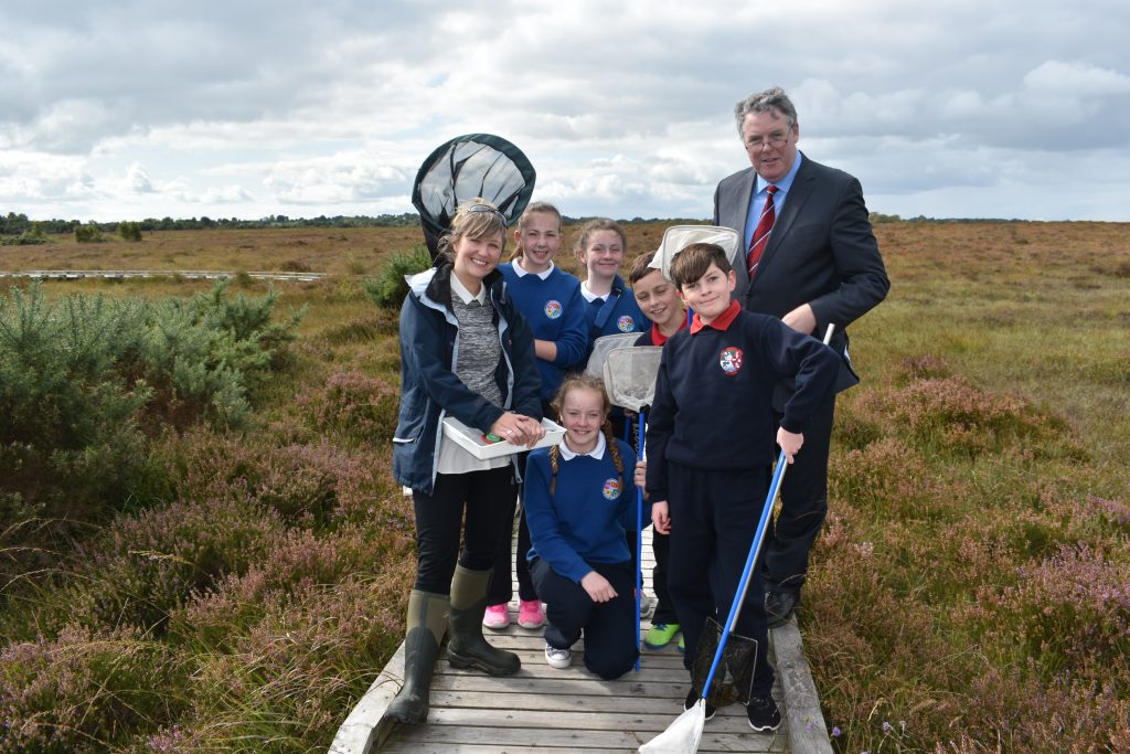
RTÉ’s news reporter and midlands editor Ciaran Mullooly reported on The Living Bog launch, bringing Clara Bog to hundreds of thousands of TV viewers and millions online. Local schoolchildren from Scoil Bhride and Scoil Phroinsias Naofa brought Ciaran on a tour of the bog with guides Rebecca Dobson of Clara Bog Visitor Centre and George Smith of The Living Bog.
The Living Bog team will be extending their community reach over the coming months, and will also be developing a schools programme with hundreds of schools. The project is also creating a history of midlands bogs and have urged locals in all 7 counties who have bog memories – be they of wildlife, work and tall tales – to contact them via email life@raisedbogs.ie or contact Ronan Casey at 076 1002627.
The launch and associated tour of Clara Bog were filmed by Irish national broadcaster RTÉ, and Midlands Editor and reporter Ciaran Mullooly created an impressive report which aired on the Irish national news at 6:01pm that day. It is also online HERE.
Well-known nature photographer Tina Claffey was among those at the launch and she was delighted to give the Minister the very first edition of her new bog photography book ‘Tapestry of Light’ to the Minister. The book has been part-supported by The Living Bog and the Department of Culture, Heritage and the Gaeltacht and is available nationwide in all good book stores and online HERE.
Below you will see a photo gallery from the launch.
You read about the launch on the Department website HERE
Birr nature photographer Tina Claffey presented the first copy of her new book ‘Tapestry of Light’, which was part-funded by ‘The Living Bog’ and the Department of Culture, Heritage and the Gaeltacht to Minister of Culture, Heritage and the Gaeltacht Heather Humphreys at the ‘Living Bog’ launch. She is pictured with Ronan Casey of ‘The Living Bog’.
By John Cody, Project Hydrologist
It is a long accepted fact that active bogs sequester carbon from the atmosphere and potentially contribute to mitigating human induced climate change. However the scale of this climate change mitigation potential has been the subject of debate. Bogs are dynamic ecosystems and a bogs status as a sink or source of atmospheric green house gases is determined by ecological and climatic conditions. Thus the role of an active bog in mitigating climate change is variable in time and space.
The National Parks and Wildlife Service, through The Living Bog project, has initiated a collaboration with scientists from Trinity College Dublin and Carl Stuart Group to monitor how much carbon is lost from raised bogs in discharge from drainage networks. This project will use a Florescent Organic Matter (FDOM) sensor and a YSI EXO2 Sonde to continuously monitor drainage discharge rates and concentrations of dissolved organic carbon and dissolved organic nitrogen from raised bog Special Areas of Conservation (SAC) sites to determine the mass of carbon and nutrients exported from the bogs through drainage.
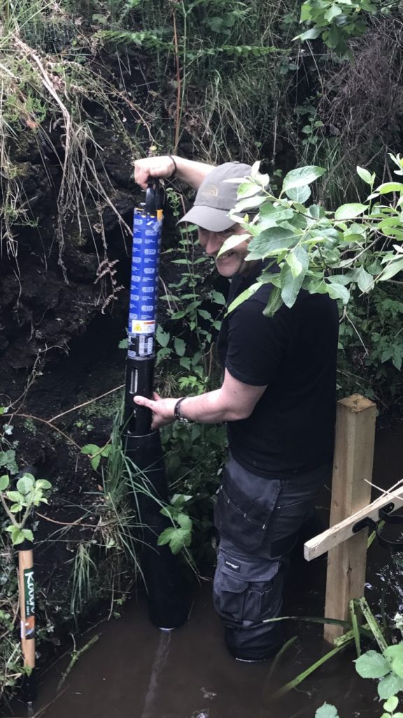
Project Hydrologist John Cody installs an EXO2 Sonde
Under natural conditions peat accumulates in an active peat forming layer known as the acrotelm, at a rate of about 1 mm per year, as the main peat forming plants- sphagnum mosses actively grow in the spring and summer, removing CO2 from the atmosphere and converting it to biomass through photosynthesis.
Similar to a deciduous forest, as the sunlight of summer yields to the creeping gloom of winter, active growth ceases. As the leaves begin to drop from the trees the living sphagnum of the summer dies back and litter accumulates in the pools and lawns of the bog. In a forest fallen leaves are rapidly decayed, returning the carbon stored in their tissues to the atmosphere as the green house gases carbon dioxide, methane and nitrous oxide. In contrast the unique conditions found in bog habitats prevents the decay of the sphagnum litter, causing an almost imperceptible growth in the acrotelm, giving active bogs the ability to sequester carbon from the atmosphere.
Sphagnum mosses make the water in the acrotelm layer acidic enough to inhibit the bacterial decay processes. In addition to the acidity of the water, the water logged nature of the acrotelm results in anoxic conditions below the surface, further impeding aerobic decay processes. Thus an undisturbed acrotelm actively maintains the conditions for peat formation.
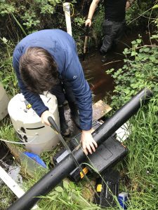
Dr Shane Regan installing the stilling well and static tube for the EXO2 Sensor
The plumes of peat smoke rising from chimneys all over Ireland in the winter air are the visible return of carbon dioxide to the atmosphere that was removed and stored in the living bogs several thousand years ago, perhaps at a time when climate change was driving the extinction of woolly mammoths. The process of carbon loss from the bogs does not end there. In order to produce peat for the fire several meters depth of the bog will have been disturbed establishing an ongoing, destructive feedback loop.
The drainage required to allow peat exploitation causes increased water discharge from the bogs, resulting in dissolved and particulate carbon losses in drainage discharge. The lowered water levels expose large areas of peat to the atmosphere, allowing microbial decay, which results in a continuous, invisible release of green house gases. In addition to CO2 these decay processes produce methane, which is 30 times more potent as a green house gas than carbon dioxide. As the bog dries the sphagnum dies back causing a reduction in the acidity of the bog waters further reducing the bog’s ability to actively sequester carbon.
The Living Bog project is a 5 year conservation project, funded through the European Union LIFE Nature and Biodiversity fund and the Department of Arts, Heritage, Regional, Rural and Gaelteacht Affairs. It’s objective is to restore peat active peat forming conditions on 12 raised bog SAC’s previously impacted by turf cutting. In the process the project will monitor the impact of restoration on the rates of export of carbon from in drainage from the sites.
The Living Bog project is the first time that FDOM sensors have been deployed in monitoring dissolved organic carbon in discharge from the bogs. The deployment of these sensors in terrestrial environments has only begun recently, as climate scientists have begun to recognise the importance of dissolved organic matter in terrestrial nutrient cycles. Carl Stuart Group and YSI have agreed to donate an EXO2 Sonde free of charge to the project for six months. The Sonde has been installed at an existing monitoring CO2 point on Clara bog, established by Trinity College.
Previously this monitoring point had employed traditional Grab sampling approaches. One of the limitations of this approach is that it is difficult to detect changes in carbon concentrations in response to storm events. The ability to continuously monitor flow rates and concentrations simultaneously provided by the EXO2 Sonde will allow researchers to quantify the mass of dissolved carbon exported from the bogs, and factors that influence background rates.
It is expected that through these activities the Living Bog project can begin to quantify the contribution of Irish raised bogs in carbon sequestration, and whether in fact your local bog can help save the planet.
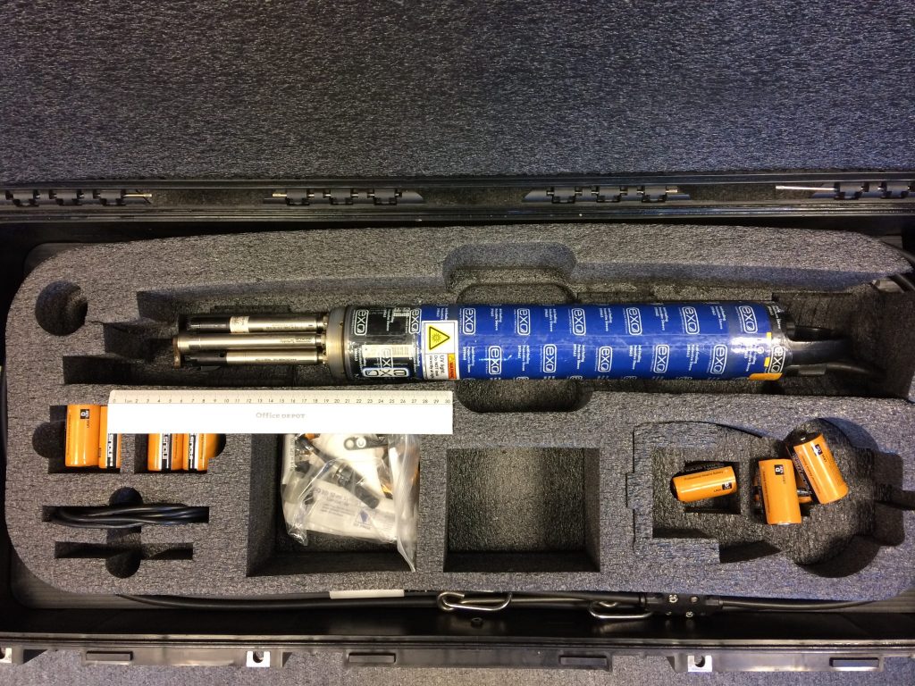
The kit, with thanks to the Carl Stuart Group
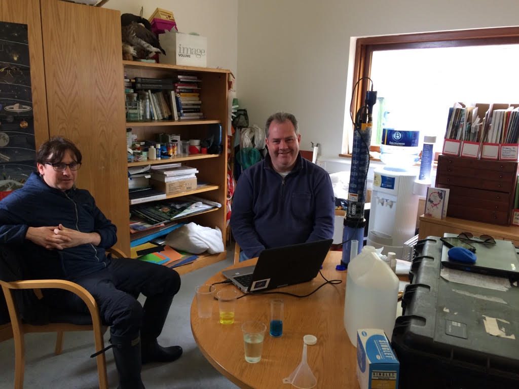
Dr Shane Regan (TCD) and Dr Ken Scally (Carl Stuart Group) prepare the EXO2 Sonde for deployment
MÁIRE NIC AN BHAIRD agus PORTACH AN FHÉIR BHÁIN
Rugadh Máire Nic an Bhaird i mBaile Uí Fhloinn in aice leis an bhFéar Bán ar an 27 Aibreán 1827, agus ba í an leanbh ab óige í ag an Urramach Rí Anraí agus a bhean Harriette. Cuireadh oideachas uirthi féin agus ar a deirfiúracha sa bhaile, mar a rinneadh le formhór na gcailíní ag an am. Mar sin féin, bhí a cuid oideachais beagáinín difriúil toisc go raibh cáil na heolaíochta ar an teaghlach. Bhí suim aici sa dúlra ó bhí sí an-óg, agus faoin am a raibh sí trí bliana d’aois bhí sí ag bailiú feithidí, an chuid is mó acu amuigh ar Phortach an Fhéir Bháin!
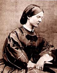
Máire Nic an Bhaird
Tharraing Nic an Bhaird feithidí freisin, agus thug an réalteolaí James South faoi deara go ndearna sí amhlaidh lá amháin. Bhí gloine formhéadúcháin á húsáid aici chun na sonraí beaga bídeacha a fheiceáil, agus chuaigh a líníocht chomh mór sin i bhfeidhm air gur chuir sé ina luí láithreach ar a hathair micreascóp a cheannach di. B’in an tús a bhí le paisean a bheadh aici ar feadh an tsaoil. Thosaigh sí ag léamh gach rud a d’fhéadfadh sí a aimsiú faoi mhicreascópacht, agus mhúin sí í féin go dtí go raibh saineolas aici. Rinne sí a sleamhnáin féin as sliseoga eabhair, mar bhí sé deacair gloine a fháil, agus d’ullmhaigh sí a heiseamail féin. D’iarr an fisiceoir David Brewster uirthi a chuid eiseamail mhicreascóip a dhéanamh, agus d’úsáid sé a líníochtaí i gcuid mhaith dá leabhair agus dá ailt.
Ag an am, ní ghlacfadh Ollscoileanna ná formhór na gcumann le mná, ach tháinig Nic an Bhaird ar eolas ar bhealach ar bith a d’fhéadfadh sí. Scríobh sí go minic chuig eolaithe, ag fiafraí díobh faoi pháipéir a bhí foilsithe acu. I rith bhliain 1848, roghnaíodh Parsons mar uachtarán ar an gCumann Ríoga, agus de bhrí go dtéadh sí ar cuairt chuig a theach i Londain, bhuaileadh sí le go leor eolaithe.[4]
Bhí sí ar dhuine den triúr ban a bhí ar an liosta seoltaí don Chumann Réalteolaíochta Ríoga (ba iad an Bhanríon Victoria agus Mary Somerville an bheirt eile).
Mhaisigh sí a sé leabhar agus a cuid alt í féin, chomh maith le go leor leabhar agus páipéar le heolaithe eile.
Eolaí mór le rá ba ea í, agus is míorúilt í gur mhair Portach an Fhéir Bháin, faoi scáth stáisiún cumhachta dóite móna, ar chor ar bith. Is é sin an suíomh ina ndearna sí go leor dá cuid aimsithe, agus tá súil againn go spreagfaidh sin go leor eolaithe óga a lorg a leanúint.
Bhí lúcháir orainn in 2018 go raibh muid mar chuid de thaispeántas tumtha a cheap an grianghrafadóir Tina Claffey agus an t-ealaíontóir Caroline Conway ‘Mary Ward’s World of Wonder‘. Cuir an seó in áirithe inniu do do scoil, coláiste nó pobal!
Eolas ANSEO
FOIRMIÚ PHORTACH AN FHÉIR BHÁIN
Meastar go bhfuil SAC Phortach an Fhéir Bháin os cionn 10,000 bliain d’aois, agus gur cruthaíodh in imchuach é, ina raibh aolchloch faoi den chuid is mó, agus saothruithe saibhir i gcré os cionn na buncharraige Tá cruinneachán ardaithe aige agus is suíomh uathúil é ó thaobh an tionscadail LIFE seo de, mar gheall ar a chóngaraí is atá sé do bhaile an Fhéir Bháin. Níl sé ach achar gearr ó cheann eile dár suíomhanna tionscadail freisin: SAC Mhaigh Cláir.
Thosaigh an portach ardaithe anseo ag forbairt sa loch imchuach ina raibh coinníollacha anaeróbacha. Cuireadh cosc ar dhíscaoileadh iomlán ábhar plandaí. Le himeacht aimsire chruthaigh an t-ábhar plandaí neamhdhian seo sraith thiubh mhóna a d’ardaigh i dtreo dhromchla an locha. Faoi dheireadh rinne seiscí ionradh ar an móin dhromchla chun eanach a fhoirmiú. Ramhraíodh an ciseal móna eanaigh ionas nach raibh fréamhacha na bplandaí a bhí ag fás ar an dromchla ag mothú an screamhuisce atá saibhir le cailciam a thuilleadh. Ba é uisce báistí an t-aon fhoinse mianraí do phlandaí, rud atá an-bhocht i mianraí. Thosaigh speicis phortaigh ardaithe, cosúil le caonach Sfagnaim ag ionradh agus sa deireadh d’athraigh an t-eanach ina phortach ardaithe.
Bíonn dhá shraith hidreolaíocha i bportaigh ardaithe: bíonn an ciseal uachtarach an-tanaí, ar a dtugtar an acraiteilm, níos lú ná 50cm ar doimhneacht de ghnáth, agus is gais bheo de chaonach Sfagnaim, ábhar plandaí marbha agus uisce a bhíonn ann. De réir meáchain, d’fhéadfadh uisce a bheith i suas le 98% de phortach ardaithe agus gan ach ábhar soladach a bheith ina 2%. Coinnítear an méid seo uisce laistigh de bhlúirí caonach Sfagnaim marbh.
Bíonn dhá shraith hidreolaíocha i bportaigh ardaithe: bíonn an ciseal uachtarach an-tanaí, ar a dtugtar an acraiteilm, níos lú ná 50cm ar doimhneacht de ghnáth, agus is gais bheo de chaonach Sfagnaim, ábhar plandaí marbha agus uisce a bhíonn ann. Bíonn tréscaoilteacht ard ag an acraiteilm san uisce gar don dromchla, ach éiríonn sé níos neamhscagtha le doimhneacht de réir mar a éiríonn an mhóin níos comhdhlúite agus níos dianscaoilte (tais). Ciallaíonn gluaiseacht uisce agus luaineachtaí go bhfanann coinníollacha san acraiteilm aeróbach den chuid is mó agus is anseo is láidre a bhíonn gníomhaíocht mhiocróbach. Tá an acraiteilm ríthábhachtach d’fhorbairt agus d’fheidhmiú portach ardaithe.
Thíos faoi seo bíonn an mhóin i bhfad níos tibhe, ar a dtugtar an catotelm, áit ar thit gais phlandaí aonair faoi mheáchan caonaigh os a gcionn chun mais éagruthach dhorcha Sfagnaim a tháirgeadh; is blúirí iad. De ghnáth bíonn móin catotelm comhdhlúthaithe go maith agus an-tais go minic. Bíonn sé sáithithe go buan le huisce. Bíonn gluaiseacht uisce tríd an móin éagruthach seo an-mhall, níos lú ná méadar sa lá de ghnáth. Seo an áit a stóráiltear an chuid is mó d’uisce na báistí.
De bhrí gur draenáil dhomhain a bhaineann le baint mhóna, d’fhulaing an Féar Bán san am atá thart, agus an deisceart agus an t-oirthear trasnaithe ag draenacha.


San am a chuaigh thart, bhí gearradh móna ó thuaidh agus soir ón suíomh suntasach Tá sraith línte tarraingthe ar léarscáil 1910, 6″, de réir sean-mhóincheart. Tá fianaise níos déanaí de bhaint mhóna le feiceáil ó mheaisín ispíní tréigthe a úsáideadh le móin a ghearradh i dtuaisceart agus ó dheas den suíomh (Kelly et al., 1995). Roghnaigh Bord na Móna an portach le forbairt mar fhoinse móna in 1983. Níor tharla sé seo agus aistríodh an suíomh ina dhiaidh sin chuig úinéireacht na Seirbhíse Páirceanna Náisiúnta agus Fiadhúlra in 1996. Tá an chuid is mó den phortach faoi úinéireacht an phobail.
Léiríonn léarscáil 6 ” 1910, foraoiseacht in oirthear an tsuímh. Is dócha gur Péine Albanach a bhí anseo den chuid is mó. Is dóichí gur leagadh agus gur athghineadh é seo thar na blianta, le hionradh speiceas eile ar nós Beithe.
CUMHACHT AN FHÉIR BHÁIN & POST LEIS AN MBORD
Samhlaítear portaigh sa taobh seo tíre – agus go háirithe na portaigh ardaithe – le tionscal an bhreosla. Cuimhneoidh muintir an Fhéir Bháin ar an stáisiún cumhachta a leagadh, stáisiún a d’fhostaigh na mílte sa chaoga bliain a bhí sé ag feidhmiú. Ba é seo an chéad stáisiún cumhachta scaoilte móin mhuilleáilte a tógadh riamh agus a coimisiúnaíodh in Éirinn, an chéad cheann ar domhan taobh amuigh d’Aontas na bPoblachtaí Sóivéadacha Sóisialacha.
Cuireadh tús leis an tógáil in 1953 agus choimisiúnaigh an Bord Soláthair Leictreachais (E.S.B.) é in 1957 leis an gcéad fhorbairt de 60,000 cileavata. Cuireadh tús leis an dara céim d’fhorbairt 30,000 cileavata eile i mí Meithimh 1961, agus coimisiúnaíodh é i mí Eanáir 1964. Thug sé seo acmhainn iomlán an Stáisiúin go 90,000 cileavata, agus é in ann thart ar 400 milliún aonad leictreachais a tháirgeadh in aghaidh na bliana.
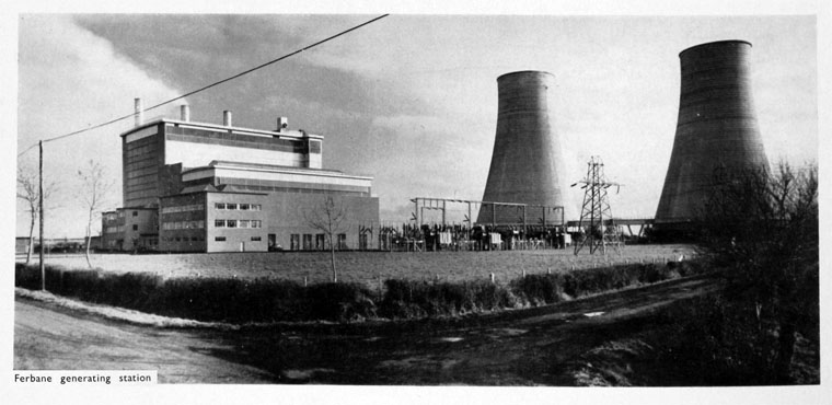
Ag a bhuaicphointe sna 1970í agus sna 1980í, dhóigh an stáisiún 2,000 tonna móna go laethúil, agus táirgeadh thart ar 2 mhilliún aonad leictreachais go laethúil nuair a bhí a cheithre aonad faoi lánlód. Tugadh an mhóin mhillte isteach ar an traein ar thomhaslínte caola, ó ionaid Loch na Buaraí den chuid is mó. Bhí gaileadán, tuirbín, gineadóir agus claochladán i ngach aonad. Tháirg gaileadáin 1, 2 agus 3 (an chéad fhorbairt) 100 tonna gaile san uair, ag brú 30 kg/cm2 agus teocht 440°C chun tuirbíní Brown Boveri 20MW a thiomáint agus gineadóirí ceangailte go díreach ag 3,000 imrothlú in aghaidh an nóiméid. Bhí gaileadán 130 tonna san uair ag an 4ú aonad (an dara forbairt) a thug gaile ag brú 63 kg/cm2 agus ag teocht 510 °C a thiomáin Tuirbín 30 MW Parsons agus Gineadóir ceangailte go díreach ag 3,000 imrothlú in aghaidh an nóiméid Gineadh an leictreachas ag 10,000 volta agus athraíodh go 110,000 volta é le haistriú isteach sa ghreille náisiúnta.
(Scannán ó Chartlann Scannán Huntley)
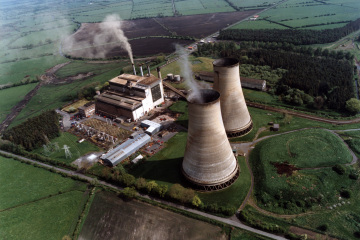
Bhí an stáisiún ag éirí sean, áfach, agus faoi lár na 1990í bhí an stáisiún as feidhm agus níor chuir sé mórán ar fáil don Ghreille Náisiúnta Moladh go ndúnfaí é sa bhliain 1998. Ní raibh a dhúnadh gan chonspóid, áfach, mar a thuairiscigh The Irish Independent in 1998 agus The Irish Times in 2001. Ní raibh cumhacht curtha ar fáil aige le beagnach trí bliana sular dúnadh é faoi dheireadh. . Tosaíodh a leagan sa bhliain 2003, agus tá taifead déanta ag an BSL ar a leagan ANSEO.
Dá mairfeadh Stáisiún Cumhachta an Fhéir Bháin san 21ú haois, b’fhéidir go mbeadh cinniúint SAC Phortach an Fhéir Bháin difriúil agus b’fhéidir go mbeadh stoc simléir i gceist. Mar sin féin,an bportach
Ní féidir a shéanadh gur fhulaing bailte cosúil leis an bhFéar Bán nuair a dúnadh na gléasraí cumhachta, nuair a tharla an meicniú agus nuair a ghlac Bord na Móna tréimhse fhada imeachta ón bhaint mhóna. Mar a léiríonn an t-iriseoir Rodney Farry ANSEO i bpíosa san Irish Times, bhí post le Bord na Móna ar an rud ab fhearr: “D’fhir óga san Fhéar Bán agus sna sráidbhailte máguaird, thug teacht ar phost buan leis an mbord, mar a thugann muintir na háite air, thug sé slándáil poist agus pinsean cinntithe dóibh, rud a bhí annamh in Éirinn sna 1950í.”
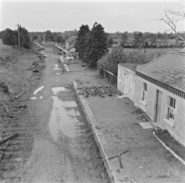
STÁISIÚN TRAENACH AN FHÉIR BHÁIN
Tráth dá raibh, bhí an Féar Bán ina phríomhstad don turas 17 míle ó Chlóirtheach go Beannchar, a thóg Iarnród Chlóirthigh agus Bheannchair agus osclaíodh é sa bhliain 1884 (tar éis tamall fada tógála de bhrí go raibh cuid mhór den bhealach ag dul trí phortach). Thosaigh Clóirtheach-Beannchar mar líne neamhspleách ach d’imigh an t-airgead agus ghlac Mór-Iarnród an Deiscirt agus an Iarthair seilbh air sa deireadh, agus nascadh an Féar Bán leis na línte agus na cinn scríbe móra go léir.
Chaill an líne a seirbhís paisinéirí sa bhliain 1947. Úsáideadh an líne d’earraí agus do sheirbhísí speisialta ó am go chéile go dtí gur dúnadh í i sciar de dhúnadh craoibhe ar fud na tíre in 1963.
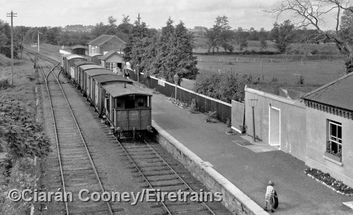
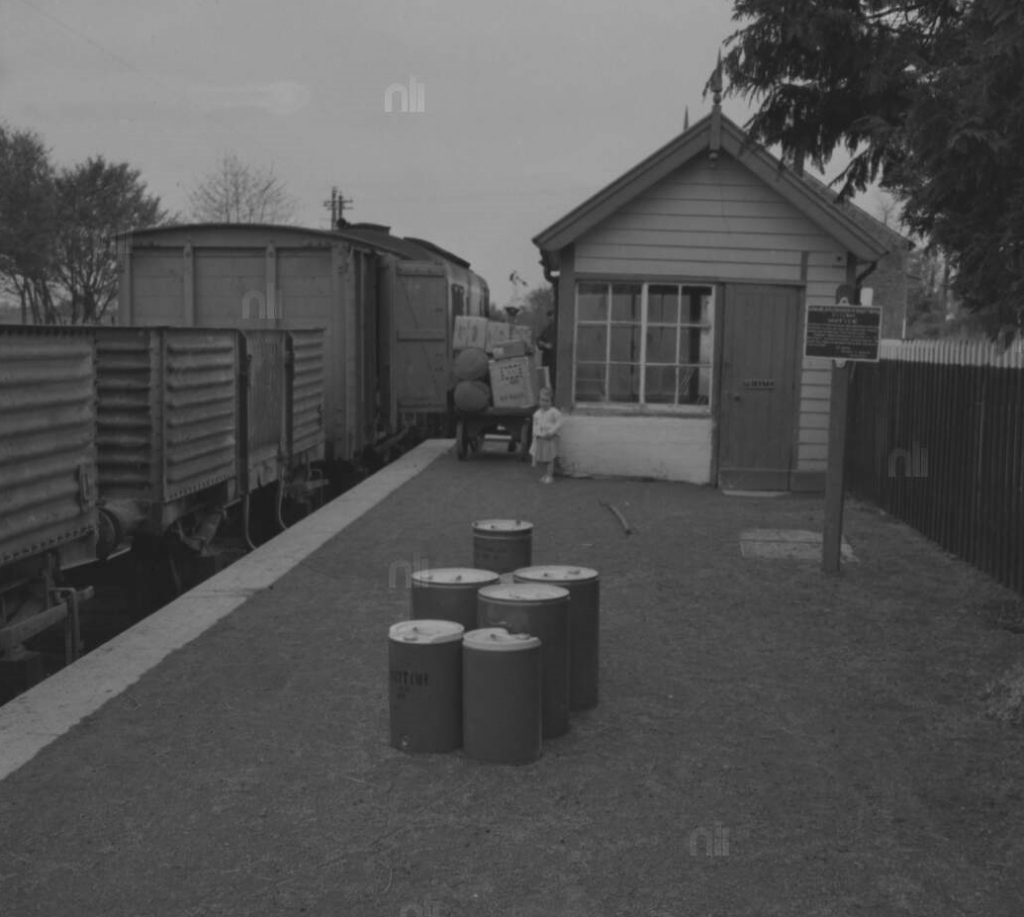
Páiste ag súgradh ar an ardán agus traein earraí CIÉ Bheannchar ag imeacht ó Stáisiún Traenach an Fhéir Bháin in 1960. (Pic: Roger Joanes/Ciaran Cooney/Eiretrains)
Agus beagán le cois trí bliana ina dhiaidh sin: Stáisiún Traenach an Fhéir Bháin in 1964, agus an líne á leagan. (Pic: Leabharlann Náisiúnta na hÉireann.)
Tá an seanstáisiún san Fhéar Bán fós le feiceáil go dtí an lá atá inniu ann, chomh maith le foirgneamh an stáisiúin, struchtúr Victeoiriach a tógadh sa bhliain 1884, chomh maith leis an tseid earraí. Rinneadh athchóiriú ar an stáisiún, agus tá oifigí tithíochta don Chomhairle áitiúil ann anois. Ó thaobh na hailtireachta de, tá an dearadh simplí agus feidhmiúil araon, agus é maisithe le cláir bhinne, earraí uisce báistí iarann teilgthe agus coirnis bhrící a fhad leis na sceimhleacha. Cosúil le go leor stáisiúin lár tíre (agus cinn eile ar chraobh Bheannchair), meascán d’fhoirgneamh aonair agus dhá stór a bhí ann.
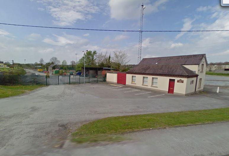
Seanstáisiún an Fhéir Bháin inniu, agus bothán na n-earraí ar chúl (is seid stórála de chuid na Comhairle atá ann anois). Níl aon líne traenach ann a thuilleadh.
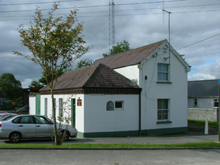
Spás Oifige: Iar-Stáisiún Traenach an Fhéir Bháin
Mar sin féin, is fada ó leagadh an t-ardán agus an bóthar a théann thar dhroichead (a d’iompair an N62), agus tá an chuid is mó den líne féin imithe le fada.
D’fhág an chraobh líne Chúil an tSúdaire-Baile Átha Luain ag Acomhal Chlóirthigh agus Bheannchair, díreach taobh amuigh den bhaile. . Bhí stáisiún ag an Lios Dearg freisin.
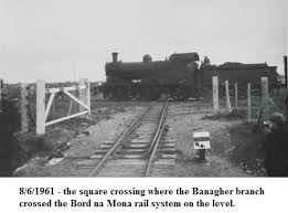
Gné neamhghnách den líne a bhí ag Portach Liath Mancháin, soir ó bhaile an Fhéir Bháin, áit a raibh trasnú leibhéal cothrom uathúil le córas cúng Bhord na Móna ag freastal ar an stáisiún cumhachta. Níl fágtha de seo ar fad inniu ach an geata. Le haghaidh tuilleadh eolais, féach suíomh Éire Trains ANSEO
CAISLEÁN NA CÚILE
Thóg Sir John MaCoghlan Caisleán na Cúile ar bhruach Bhrosna sa bhliain 1575. Ba é seo an ceann deireanach de chaisleáin Mhic Cumhaill a tógadh. Thóg sé é mar bhronntanas dá dhara bean Sabina O’Dallachain. Tráth dá raibh bhí leac mhúrmhaisithe sa chaisleán agus inscríbhinn Laidine aistrithe go Béarla “This tower was built by the energy of Sir John MacCoghlan, K.T. chief of this Sept at the proper cost of Sabina O’Dallachain on the condition that she should have it for her lifetime and afterwards each of her sons according to their seniority”
Ní fios cá bhfuil an múrphictiúr faoi láthair. Ina uacht in 1590 d’fhág Sir John Caisleán na Cúile dá bhaintreach. Thar an tinteán, ina shuíomh bunaidh, sa seomra is mó sa chaisleán tá plaic scríofa sa Mheán-Ghaeilge:
“SEAGHA (n) MAC (c) OCHL (ain) DO TINDSCAIN O SEO SUAS 1575” (“Thóg Seán Mac Cochlan (an foirgneamh seo) ón (dáta) 1575”)
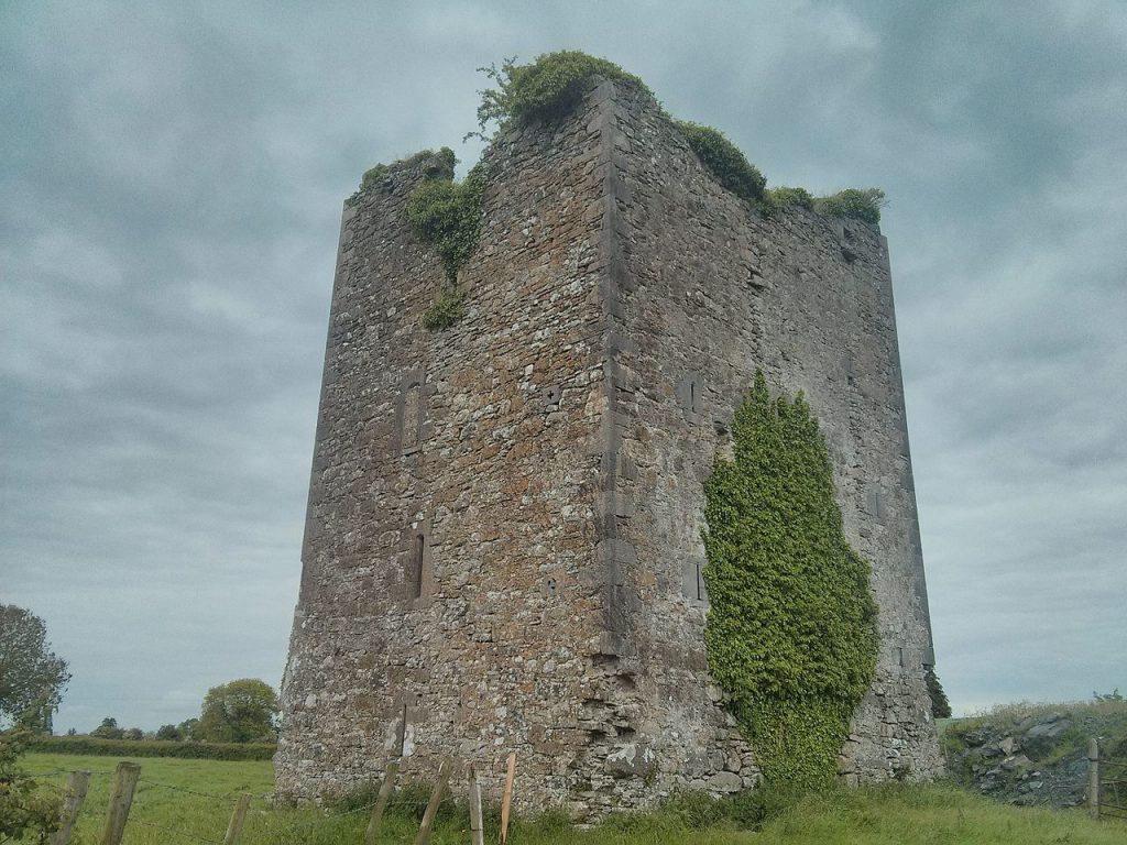 Caisleán na Cúile, An Féar Bán